TatukGIS Contributes to Native Vegetation Classification Software
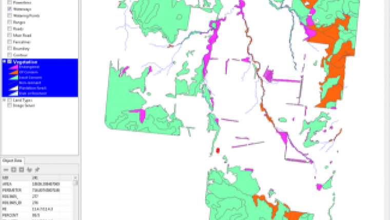
The Queensland Department of Natural Resources, Australia, has undertaken a state-wide land-cover and tree study to identify and classify all vegetation zones across the state. The primary methodology was remote sensing backed up by field surveys, resulting in the creation of a vegetation database the government uses to stipulate vegetation management guidelines by which all landholders must abide. The idea behind this effort was to assist landholders, scientists, industry and government with the world’s best-practice landscape management.
Laws were drafted governing management practices in each of the classified zones, with significant penalties for breaches of these guidelines. While GIS experts had ready access to the spatial data, individual landholders without GIS expertise were being provided a PDF map of their property. The PDF map provided insufficient accuracy to enable landholders to make decisions about use of their land without risk of accidental violations exposing the landowner to the possibility of prosecution.
The TatukGIS support for the Esri ArcView Shape format and coordinate systems (including PRJ file) was vital for this project. Its Developer Kernel (DK) visual layer property control contains functionality to associate the rendering of map features based on attribute field values, making the process of applying different colours to the vegetation zones trivial. These and other features of the DK component contributed significantly to shortening the project development cycle.
To further aid landholders identify classified zones when in the field, a GPS interface was developed to enable uploading data from the map to handheld GPS units.
The key purpose of the AGDATA development using the TatukGIS DK component has been to provide a simple-to-use GIS tool to landholders who have no formal knowledge or training of GIS. Besides compliance with land use guidelines, this effort is enabling landholders, for the first time, to engage with government authorities over landscape management decisions.
AGDATA, based in Toowoomba, Queensland, is Australia's largest agricultural software company. For more information about AGDATA Australia, visit the company website at www.agdata.com.au. For more information about TatukGIS and its GIS Developer Kernel, visit www.tatukgis.com.

Value staying current with geomatics?
Stay on the map with our expertly curated newsletters.
We provide educational insights, industry updates, and inspiring stories to help you learn, grow, and reach your full potential in your field. Don't miss out - subscribe today and ensure you're always informed, educated, and inspired.
Choose your newsletter(s)


