Teren Kicks Off U.S. Nationwide 4D Lidar Content Library Programme
Teren, a climate resilience analytics company, has expanded its Premium 4D Content programme for regions across the United States, including the Gulf Coast, Midwest, Rocky Mountains and West Coast. Teren acquires and processes high-fidelity Lidar data, makes it available via its content library, and delivers analytics with actionable insights to energy and engineering firms.
“Climate change is causing drought, flooding, landslides and wildfires across the country – significantly impacting asset owners and project developers. As a result, the market demand for high-fidelity, temporal data to identify, prioritize and monitor climate-related risk is higher than ever,” said Toby Kraft, Teren CEO.
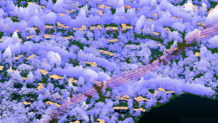
Remotely Sensed Geospatial Data
Teren is amassing a content library of remotely sensed 3D (spatial) data across the United States. That data is updated at regular intervals to monitor changes over time providing a 4D (temporal) view. This 4D data library feeds analytics that identify risk, inform mitigation and strengthen asset resilience. While remotely sensed data has traditionally been sourced on a project-by-project basis, Teren offers its data and analytics as a subscription service. This model drives down the costs for clients and stakeholders, helping to maximize the speed of delivery, return on investment and data value.
“In our flagship content region, Appalachia, our customers tap into our 4D content library to identify and monitor the terrain and surface conditions surrounding their assets – primarily aiming to identify and mitigate landslides before they become catastrophic incidents,” said Kraft. “We’re expanding the programme nationwide to meet the growing demand for terrain monitoring and climate resilience analytics around events such as erosion, flooding, wildfire and more.”
Erosion, Land Movement and Flooding
According to Teren, its solution saved clients in Appalachia an estimated US$152 million annually – preventing 24 failures per year due to landslides and saving roughly 15 billion cubic feet per day of natural gas from leaking. While landslides are not as pervasive across the United States, companies can apply the data and analytics suite for the following: Gulf Coast – inundation, subsidence, land movement; Midwest – erosion, flooding, subsidence; Rock Mountains – landslides, flooding, wildfire; and West Coast – wildfires, land movement, flooding.
Traditionally used by the energy sector, Teren’s data has also proven to be highly valuable to state and federal agencies, insurers and civil engineers. Teren expects to see increased variability across clients and use cases as the content expands.
“Teren’s highly accurate terrain data and climate resilience analytics provide developers and operators with critical insights at unmatched speed and cost-efficiencies,” Kraft added.

Value staying current with geomatics?
Stay on the map with our expertly curated newsletters.
We provide educational insights, industry updates, and inspiring stories to help you learn, grow, and reach your full potential in your field. Don't miss out - subscribe today and ensure you're always informed, educated, and inspired.
Choose your newsletter(s)


