
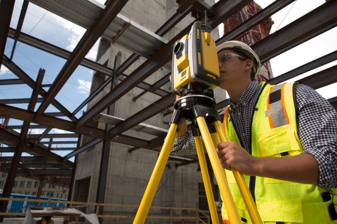
The Abundance of Prospects for Surveyors in the Building Industry
How can geospatial professionals seize new oppportunities in the AEC industry? Although the construction sector currently has a lower level of digitalization than nearly every other industry, the sector is evolving and geospatial technology will play a key role in its future. BIM is one example of digitalization in the construction industry, and it is changing the way surveyors work, collaborate and do business. We have selected a number of articles that provide an overview of the AEC industry’s needs and the associated opportunities for mapping and surveying professionals.
Bridging the Gap between Geospatial and Construction
There is a gap in information exchange between the geospatial and construction domains. This is a serious issue, mainly because geospatial systems and engineering surveys are not yet aligned and integrated with building information modelling (BIM). The BIM method is expected to move construction activities from plan-based individual work to model-based collaboration. Such a paradigm shift will bring huge opportunities regarding planning, building and management of the built environment in a more productive, open and sustainable way. Although it is still difficult to entirely close the gap between these two fields, this article shows how that gap can at least be narrowed.
The Merging Worlds of Spatial Data and Construction
After a slow, decades-long start, the digitization of construction has finally gained a firm foothold. While it is true that digital models are often used – and sometimes required – to visualize how a building will come together, true digital construction goes well beyond mere visualization. Project owners, engineers and contractors are now looking at and adopting new ways of digitizing their own workflows and finding new ways to collaborate on projects to improve predictability and reduce risk. For surveyors looking for new opportunities in construction, these changes will likely require some new approaches to satisfy the needs of increasingly sophisticated projects and players.
How Can Surveyors Optimally Profit from the Digitalization in the Construction Industry?
Topcon, a global positioning partner for construction and geospatial businesses, sees building information modelling (BIM) as not just a benefit, but a requirement. Here, Cesar Mendoza, the company's product manager for vertical construction, discusses how surveyors can optimally profit from the digitalization in the construction industry and the trend towards BIM. He believes the UK government’s Construction Strategy, published in 2011, serves as a good example and has had a major impact on the uptake of BIM in the UK.
The Role of Surveyors in the Evolution of BIM
Building information modelling (BIM) is becoming more commonplace within construction sectors globally, combining technology with improved collaboration to better manage projects and give them the best chance of complying with time and budget constraints. However, the BIM life cycle and efforts to espouse it are almost futile if surveying is taken out of the equation or, more realistically, brought in too late. It can be good to have a structure that is successfully using BIM to be delivered on time and within budget, but if it or any of its components are in the wrong position, the consequences can be catastrophic.
3D Modelling for Construction
When it comes to 3D modelling for construction, what are the advantages and disadvantages of photogrammetry versus Lidar in terms of accuracy, complexity and cost? Breaking away from laser measurement in construction is a taboo subject, perhaps hampering the use of photogrammetry. In construction, aerial survey has enormous time-saving benefits for measuring groundwork areas. Data can be used for asset classification and construction validation as well as health and safety. In particular, regular scans provide a time series of work in progress to detect new issues, managing risk rather than responding to it. This article looks at the state of the art.

Value staying current with geomatics?
Stay on the map with our expertly curated newsletters.
We provide educational insights, industry updates, and inspiring stories to help you learn, grow, and reach your full potential in your field. Don't miss out - subscribe today and ensure you're always informed, educated, and inspired.
Choose your newsletter(s)


