The growing versatility of employing Lidar technology
Lidar owes its growing popularity to the accuracy and high resolution with which it maps the environment. Continued technological advances are resulting in even better usability, reliability and sustainability, while cost reductions are making Lidar increasingly accessible for a wide range of commercial applications. Here, we present a selection of appealing articles demonstrating a number of – sometimes surprisingly practical – examples.
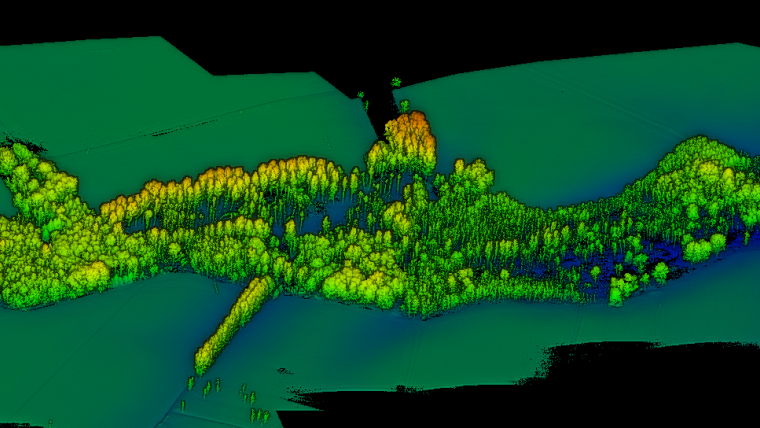
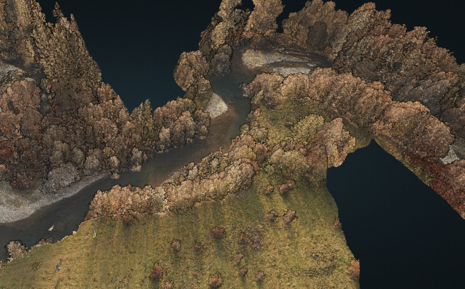
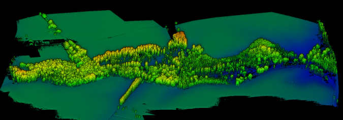
Underwater deadwood and vegetation from UAV-borne topobathymetric Lidar
The monitoring of submerged deadwood and vegetation is gaining increased attention due to their socio-economic and ecological importance. Deadwood acts as an important underwater habitat but also poses a threat to bridges, hydroelectric power plants and riverside buildings. Underwater vegetation, in turn, is a proxy for climate change in general and global warming in particular. In this context, UAV-borne topobathymetric laser scanning constitutes a promising tool for accurately capturing and modelling these small-scale objects in high spatial resolution.
The use of airborne Lidar to visualize history in 3D
Airborne Lidar and 3D modelling technologies have emerged as highly valuable geospatial tools available to archaeologists in their efforts to gain insights into key historical sites. Being able to accurately visualize how a fort, battlefield or settlement appeared at critical times creates a narrative revealing the way important events played out. Just as importantly, 3D visualization enables the researchers to plan where to focus additional fieldwork, including excavation and geophysical surveys.
UAS Lidar survey over an ancient Pueblo site
Archaeologists have been studying the Sand Canyon Pueblo in Colorado, USA, for decades. Today, painstaking traditional mapping and visualizations no longer suffice for detailed studies. A survey combining an unmanned aerial system (UAS) with Lidar has shown how accurate and dense point clouds enable the discovery of previously undocumented structures. However, conducting a UAS Lidar survey requires thorough knowledge and skills, as the author convincingly demonstrates.
Creating a 3D model of the famous Budapest Chain Bridge
Two Hungarian companies designed a three-step data collection workflow to overcome the challenges in this urban surveying project, which included the use of UAVs and remote-controlled boats for Lidar and photogrammetry data. The result: a digital 3D BIM-compatible model of Budapest’s iconic bridge over the River Danube to assist in preparations for restoration and renovation work.
UAS Lidar for ecological restoration of wetlands
Wetlands are essential ecosystems which provide numerous benefits to society as a whole. But their functionality strongly depends on the hydrology and topography of the watershed, thus creating the need for monitoring. The use of terrestrial topographical survey methods can be a challenging task in wetlands, however. Flooded areas, muddy terrain and low vegetation can substantially slow down or even prevent the movement of surveyors, while tall vegetation can obstruct GPS reception. As this article outlines, advanced technologies such as airborne or UAS Lidar offer interesting alternatives for surveying the hydrology and topography of wetlands.

Value staying current with geomatics?
Stay on the map with our expertly curated newsletters.
We provide educational insights, industry updates, and inspiring stories to help you learn, grow, and reach your full potential in your field. Don't miss out - subscribe today and ensure you're always informed, educated, and inspired.
Choose your newsletter(s)


