The versatility of UAVs for mapping and surveying
In recent years, the UAV has outgrown its status as a disruptor to become a standard part of the surveyor’s toolkit for capturing the environment. One thing that makes the unmanned aerial vehicle so beloved is its versatility, which is illustrated in this selection of articles by GIM International. They highlight the multitude of possibilities of drones for wide-ranging applications in various circumstances.
Automated extraction of road information from UAV-based data
When it comes to monitoring the condition of roads, UAV technology can overcome many of the downsides associated with traditional methods which can be time-consuming, labour-intensive and sometimes subjective. This article explores the opportunities for automated extraction of UAV-based data information about road construction, inventory and road environments.
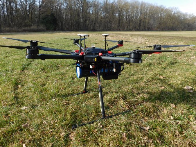
Integrating UAV-based Lidar and photogrammetry
Recent UAV platforms jointly collect imagery and Lidar data. Their combined evaluation potentially generates 3D point clouds at accuracies and resolutions of some millimetres, so far limited to terrestrial data capture. This article outlines a project that integrates photogrammetric bundle block adjustment with direct georeferencing of Lidar point clouds to improve the respective accuracy by an order of magnitude. Further benefits of combined processing result from adding Lidar range measurement to multi-view-stereo (MVS) image matching during the generation of high-precision dense 3D point clouds.
Soil mapping with drones
In the Earth sciences sector, sensors for measuring properties of the Earth are rapidly becoming adapted for drone use now that new developments in technology have led to an increase in the size and payload of unmanned aerial vehicles (UAVs or ‘drones’). This article presents two studies that explore the opportunities for adding a gamma-ray spectrometer to a drone in order to map the texture or contamination of soil.
What to consider before using UAVs for land administration projects?
UAVs deliver tailored orthoimages from which spatial data – including visible parcel boundaries, building outlines and coordinates – can be derived. Many geospatial technology companies now offer high-tech UAV-based solutions, and many new hardware and software providers have also entered the market. Thanks to falling prices of UAVs, many land surveyors are now either experimenting with UAVs or already using them on a daily basis. So, what are the key questions that need answering before deciding to adopt a UAV in your next land administration project?
The challenges of surveying the Faroe Islands
Remotely situated in the northern Atlantic Ocean, roughly equidistant from Scotland, Iceland and Norway, the Faroe Islands form a rugged and rocky archipelago. The cool and cloudy weather, with strong winds and heavy rain possible all year round, means that this is a challenging survey environment. In its search for the best method to capture this stunning environment, the mapping authority has turned to UAVs. This article tells the story of mapping and surveying a truly breathtaking spot on Earth.
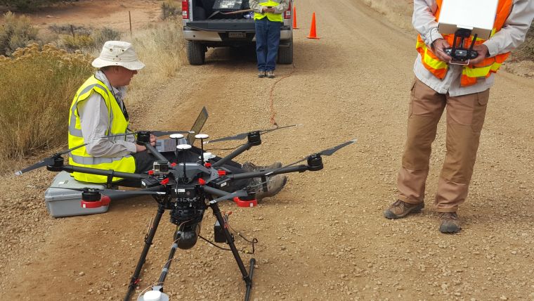
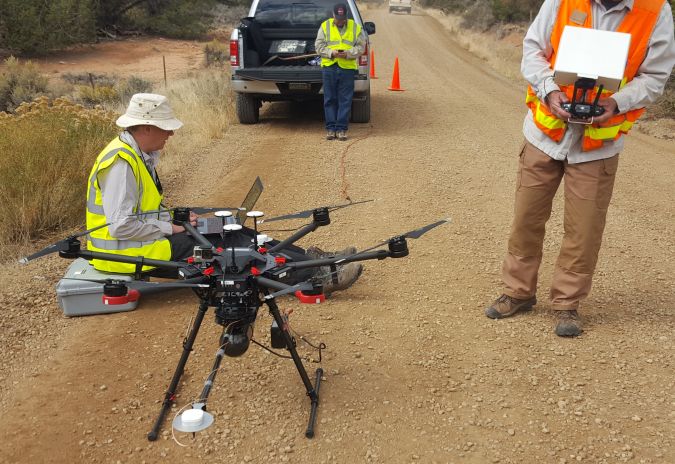
UAS Lidar survey over an ancient Pueblo site
Archaeologists have been studying the Sand Canyon Pueblo in Colorado, USA, for decades. Today, painstaking traditional mapping and visualizations no longer suffice for detailed studies. A survey combining an unmanned aerial system (UAS) with Lidar has shown how accurate and dense point clouds enable the discovery of previously undocumented structures. However, conducting a UAS Lidar survey requires thorough knowledge and skills, as the author convincingly demonstrates.

Value staying current with geomatics?
Stay on the map with our expertly curated newsletters.
We provide educational insights, industry updates, and inspiring stories to help you learn, grow, and reach your full potential in your field. Don't miss out - subscribe today and ensure you're always informed, educated, and inspired.
Choose your newsletter(s)


