thinkWhere Launches Latest Version of Location Portal GroundMapper
This article was originally published in Geomatics World.
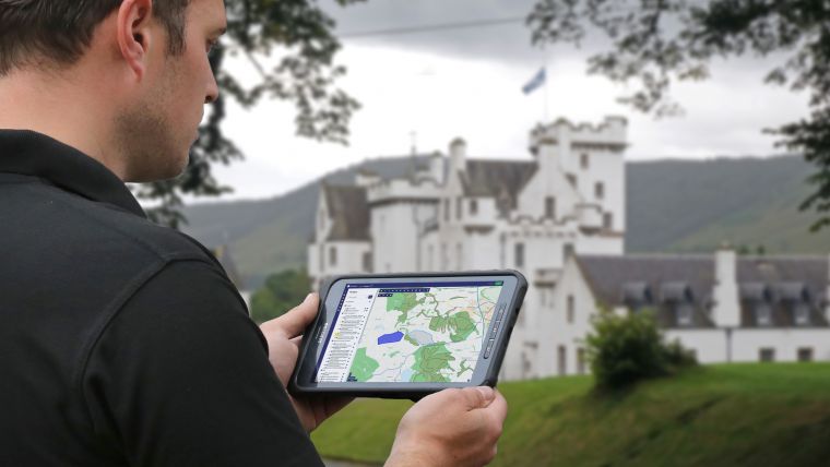
thinkWhere has released the latest version of its Geographic Information System (GIS) groundMapper to respond to the growing challenges facing land and property clients related to data quality, accuracy and speed to access the same data across projects. thinkWhere transforms how its clients access location data from traditional and manual methods of data collection and sharing to provide multiple stakeholders access to data and their own business intelligence, anytime from anywhere.
groundMapper is a Software-as-a-Service (SaaS) offering and the new Advance portal provides enhanced project management for location enabled projects with powerful capabilities for creating and managing workflows. groundMapper Advance includes easily customised templates, allowing users to create tailor-made maps and land-based reports which can be updated and shared with colleagues, contractors and other stakeholders. This alleviates the current challenges for ‘casual users’ who use location data but perceive GIS as too technical.
groundMapper Advance also provides a definitive source of land and property information with easy access to over 300 mapping layers from any web-connected device. This helps improve project management and reporting in sectors such as land and property, agriculture, forestry, utilities, infrastructure and development.
Connecting multiple stakeholders
“groundMapper is already transforming workflows across a variety of sectors where access to reliable, repeatable and accessible geographic intelligence is vital to clients' day-to-day activities,” commented Alan Moore, chief executive of thinkWhere. “groundMapper still provides an unbeatable library of definitive location data available built on open source technology. However, the new Advance portal empowers the user to manage who accesses what data by creating new users, accounts and projects, ultimately connecting multiple stakeholders across projects”
The newly released groundMapper offers enhanced tools which make it more intuitive to create and style map outputs and reports. These outputs are easily shared, both internally with stakeholders and externally with clients, contractors and the project team, and are simple to update when required. Improved search functionality allows quick access to stored information, improving project management. Improved notifications ensure users are always up to date with new features and content.
groundMapper Advance also lets a user view, query and manipulate a wide range of location data, including more than 300 individual datasets; for example, aerial photography, topographic and thematic mapping from organisations such as Ordnance Survey, the Environment Agency and the Forestry Commission. In addition, groundMapper can be used to store, access and share internal datasets, making it a single source of location intelligence for a range of applications. groundMapper also automates the reporting and royalty payments for use of external data and allows an organisation to manage user permissions.

Value staying current with geomatics?
Stay on the map with our expertly curated newsletters.
We provide educational insights, industry updates, and inspiring stories to help you learn, grow, and reach your full potential in your field. Don't miss out - subscribe today and ensure you're always informed, educated, and inspired.
Choose your newsletter(s)


