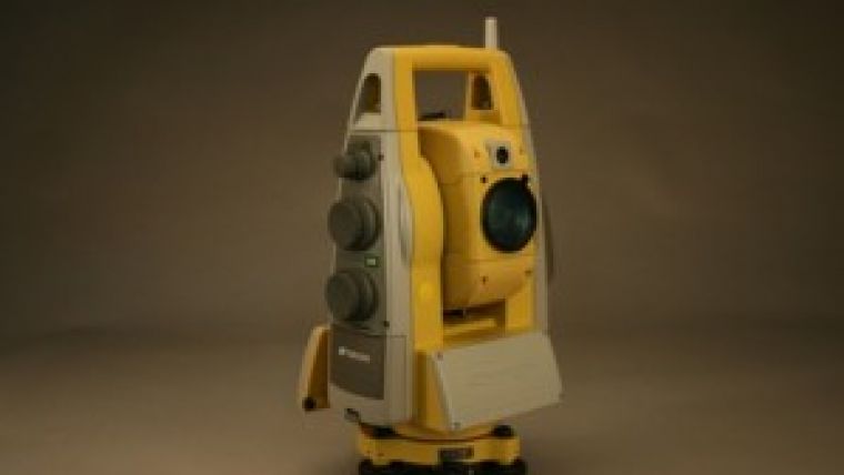
Topcon Introduces Imaging Station
Topcon Europe Positioning (The Netherlands) has introduced the newest addition to Topcon's robotic total station series - the Topcon Imaging Station - which offers the added productivity and versatility of integrated digital imaging.
Its integrated through the lens, dual digital camera imaging technology captures reality with wide angle and 30x optical zoom capabilities and when used in conjunction with the built-in scanning feature, it provides a dynamic system that provides the automation of a laser scanner. The Topcon IS is suitable for topographic survey, mining, construction, as-built survey or many other applications. Based on a Windows environment it is easy to get started and integration with the office is seamless.
With the digital imaging software you can combine multiple job site photos and create 3D models and point clouds. The Topcon IS Imaging station combines robotic survey, 3D scanning and video technologies in one compact versatile easy to operate instrument. Packed with unique technology and features, the Topcon Imaging Station offers a wide range of possibilities, unseen before. Only from Topcon: the pioneer of Digital Imaging Surveying.
The Topcon Imaging Station provides reflectorless measurement up to 2,000 metres, and speed with up to 20 points per second. The Topcon IS survey tool is also available for 3D Machine Control applications.
In May this year the Topcon Imaging Station already was released under the name of GPT-9000Ai.

Value staying current with geomatics?
Stay on the map with our expertly curated newsletters.
We provide educational insights, industry updates, and inspiring stories to help you learn, grow, and reach your full potential in your field. Don't miss out - subscribe today and ensure you're always informed, educated, and inspired.
Choose your newsletter(s)


