Trimble Expands Sensor Integration for Geospatial Monitoring
Trimble has introduced the latest version of its core geospatial automated monitoring software: Trimble 4D Control version 6.3. The software provides automated movement detection to enable informed decisions about infrastructure for surveying, construction and monitoring professionals.
Version 6.3 adds new capabilities for the software to work in combination with the Trimble SX Series Scanning Total Stations’ advanced imaging and measurement capabilities. This version also supports industry-leading vibration and weather station sensors and a streamlined workflow between the Trimble Access Monitoring Module in the field with the new T4D Access Edition used in the office.
Enhancements made to Trimble’s core geospatial monitoring software provide increased accuracy, simplified sensor data collection, reporting and alarms, and make it possible to seamlessly move from semi-automated to fully automated monitoring on a project.
More accurate measurements and sensor integration
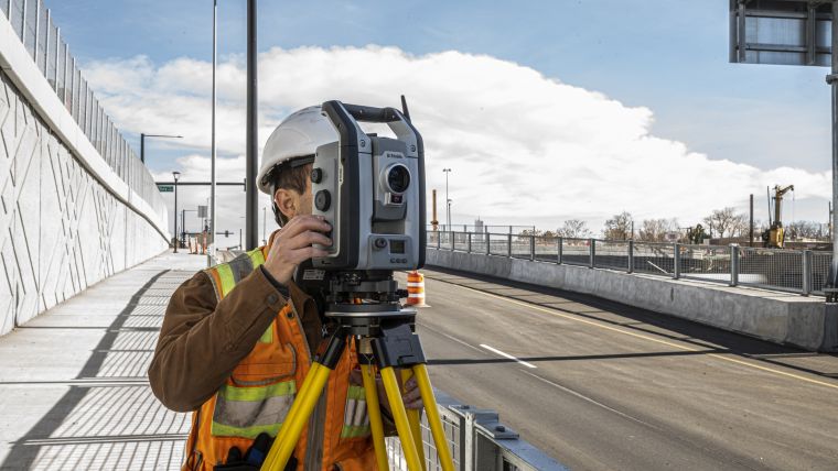
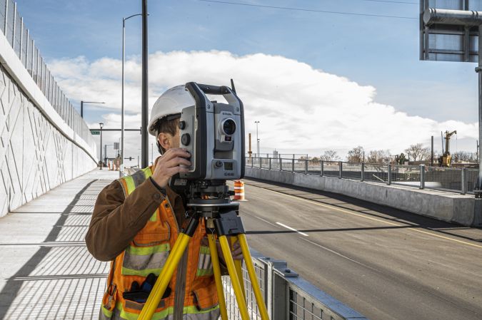
Integrating with the Trimble SX Series scanning total station, T4D users benefit from Trimble VISION imaging technology and high-accuracy Lightning 3DM technology for more accurate measurements, enabling a more dense target placement on linear corridors such as rail tracks, tunnels, roads and bridges. A live video feed makes it possible to better understand site conditions, manage target placement remotely and capture images for use with T4D visual inspection capabilities. These images can be compared over time and viewed next to the displacement or movement charts. This enables users to identify the potential cause of displacement and record movement changes over time.
Users can now integrate industry-leading solutions from Syscom and Vaisala with T4D version 6.3. Vibration sensors from Syscom allow surveying, civil and geotechnical engineers to easily combine geodetic and geotechnical information supporting high frequency and event-based vibration information. This data is often used for mandatory reporting on civil and infrastructure projects. Integration with the Vaisala weather station enables users to analyse the impact of environmental conditions such as temperature, rainfall, wind and atmospheric pressure in combination with other geospatial and geotechnical monitoring information, which is useful for slope stability analysis in mining, landslide and dam monitoring operations.
Transition from semi-automated to fully automated monitoring
With the introduction of the new T4D Access Edition, customers can now benefit from the automated, seamless transfer of field data from the Trimble Access Monitoring Module to the T4D Access software in the office. This enables users to scale monitoring operations from a semi-automated to fully automated monitoring system while maintaining the continuity of historical data in the same charts and reports.
“By integrating T4D with the Trimble SX Series scanning total stations and Trimble Access Monitoring Module, we are providing customers access to a wider Trimble solution set for monitoring applications,” said Boris Skopljak, business area director of Monitoring and Tunneling, Trimble Geospatial. “We are also continuing to expand support for additional sensors such as Syscom’s vibration sensor and Vaisala’s weather station. This enables our customers to leverage an even more comprehensive, turn-key solution.”

Value staying current with geomatics?
Stay on the map with our expertly curated newsletters.
We provide educational insights, industry updates, and inspiring stories to help you learn, grow, and reach your full potential in your field. Don't miss out - subscribe today and ensure you're always informed, educated, and inspired.
Choose your newsletter(s)


