Trimble introduces new 3D laser scanning system
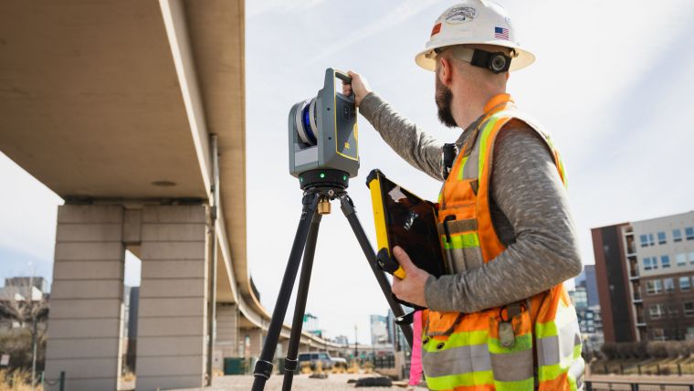
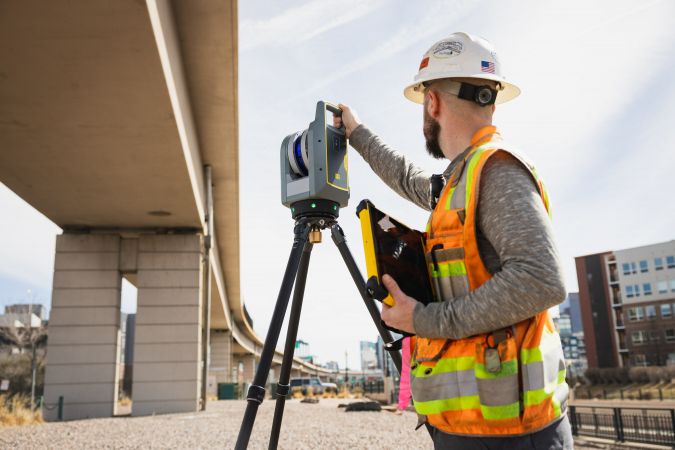
Trimble has recently announced the Trimble X9 3D laser scanning system, a versatile reality capture solution for surveying, construction and engineering professionals. The X9 is built on Trimble's proven laser scanning technologies and is engineered to enhance performance in various environments. It incorporates innovations such as Trimble X-Drive technology for automatic instrument calibration, survey-grade self-levelling, and a laser pointer for georeferencing.
The new Trimble X9 expands on the industry-proven Trimble X7, offering longer range, higher accuracy, shorter scan times and exceptional sensitivity. These improvements lead to better scan results and increased productivity. Advanced processing and a high-performance laser enhance the sensitivity of all scans, positioning the X9 at the forefront of capturing difficult dark or reflective surfaces. Additionally, a new centre unit design enhances signal transmission, resulting in better scan quality. With its more efficient reality capture capabilities, the X9 widens the range of potential applications for customers in surveying, building construction, oil and gas, rail, forensics, monitoring, tunnelling, mining and other fields.
Auto-calibration
The newly developed laser scanning system is designed to offer substantial time savings while providing extremely accurate and reliable data. This capability enables confident decision-making, both in the field and in the office, by allowing in-field registration within Trimble Perspective and Trimble FieldLink. This innovative feature minimizes the requirement for target deployment, streamlining the workflow. One of the noteworthy aspects of the system is its auto-calibration functionality, which eliminates the need for annual calibration. This not only reduces the cost of ownership but also minimizes downtime, resulting in a significant increase in users' return on investment. Moreover, the Trimble X9 is equipped with survey-grade self-levelling, boasting the industry's widest compensation range, according to Trimble. This feature enables fast and easy setup, further enhancing the efficiency of the system.
Trimble X9 data can be delivered directly from Trimble Perspective or FieldLink software to Trimble's office software, including Trimble Realworks 3D scanning software, Trimble Business Center office software, SketchUp and Tekla, or exported to industry-standard formats to produce application-specific deliverables. The Trimble ecosystem provides the software and flexibility to work the way scanning professionals want, so they can deliver what their customers need.
"Our customers buy Trimble because they want reliability and performance," said Jason Hayes, market manager, reality capture solutions at Trimble Geospatial. "The Trimble X9 is simple to use, provides unsurpassed reliability, and excels at creating high-quality digital representations of the world for applications ranging from fast-paced building documentation to challenging outdoor surveys."

Value staying current with geomatics?
Stay on the map with our expertly curated newsletters.
We provide educational insights, industry updates, and inspiring stories to help you learn, grow, and reach your full potential in your field. Don't miss out - subscribe today and ensure you're always informed, educated, and inspired.
Choose your newsletter(s)


