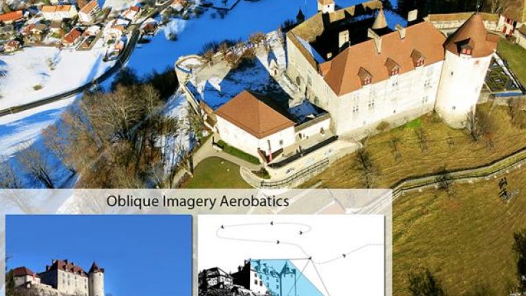
UAV Capable of Capturing Oblique Imagery
senseFly’s drones eBee and swinglet CAM, both designed for mapping missions, are capable of capturing oblique images quickly to complement a mapping project or to add additional documentation. This patent-pending technology is based on a propriatary control algorithm that takes oblique images of photo targets without the need for a camera gimbal, enabling senseFly’s ultralight mapping drones to take aerial shots with up to 45° inclination from the photo target.
The algorithms running on board the drone’s autopilot automatically place and orient the drone based on the defined image resolution and inclination (0-45°) selected by the operator. The drone then adapts its trajectory according to local wind and target altitude.
Having a system that positions the camera autonomously with respect to the photo target enables senseFly’s drone systems to take precise oblique images without the need for live video feedback or a camera gimbal.
As these new techniques do not require any hardware changes, this novelty is freely available to the full community of eBee and swinglet CAM (late 2012 model) users with the new release of eMotion 2.2.
senseFly’s latest release of Postflight Terra 3D will enable users to go one step further and add these oblique images to a standard mapping flight, adding visibility to facades and vertical surfaces.

Value staying current with geomatics?
Stay on the map with our expertly curated newsletters.
We provide educational insights, industry updates, and inspiring stories to help you learn, grow, and reach your full potential in your field. Don't miss out - subscribe today and ensure you're always informed, educated, and inspired.
Choose your newsletter(s)


