UAV Management Solution Includes Video and Telemetry Streaming
SPH Engineering has released the UgCS and its mobile companion’s UgCS for DJI update, adding support for YUNEEC H520 and MavLink2, perfecting mission editor tools and KML import. Along with the update, UgCS's centralised UAV management solution for command centres enables UgCS for DJI to stream video and telemetry to a remote UgCS instance via a secured connection.
To offer UgCS to a broader commercial market the support for YUNEEC H520 drone has been added. Support for MavLink2 is added to grant higher flexibility and security to MAVLink communication.
Added operations to mission editor provide more flexibility for drone mission planning, enabling to convert route from already calculated into editable waypoint route for single waypoint adjustment; to split route manually or by distance into separate routes or to merge several routes into one and to invert the route.
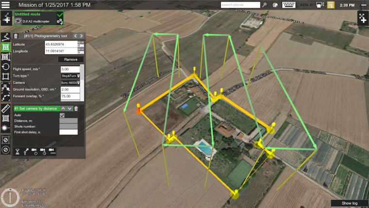
Photogrammetry
As demonstrated in UgCS CSV/KML data import tutorial (see video below), the upgrade of import functionality enables to import KML files not only as “Area Scan” or “Photogrammetry” but also as “Perimeter”.
UgCS centralised drone management solution enables command centre operators to track on the map real-time position of the drones used in-field and receive live video streams. Command centre operators can mark points of interest on the shared map to indicate locations for field drone operators for detailed inspection or even can take manual control over the drone and its camera.

Value staying current with geomatics?
Stay on the map with our expertly curated newsletters.
We provide educational insights, industry updates, and inspiring stories to help you learn, grow, and reach your full potential in your field. Don't miss out - subscribe today and ensure you're always informed, educated, and inspired.
Choose your newsletter(s)


