UAV Operator's Certificate Issued to Land Surveys
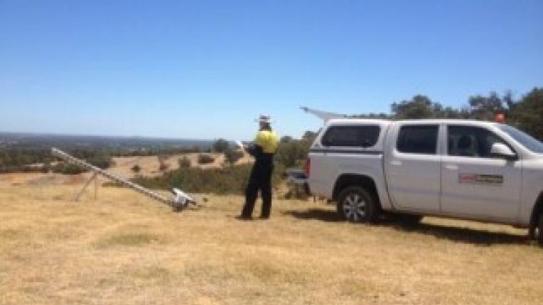
Land Surveys, Australia, is now a fully certified Australian Unmanned Aircraft Vehicle (UAV) operator. UAV Operator’s Certificate 1-URV83-01 was issued by the Australian Civil Aviation Safety Authority (CASA). This award of the UAV OC marks a significant milestone in the commercialisation of Land Surveys' UAV surveying activities and recognises that the systems and processes the company has established are in accordance with legislation and guidelines set down by CASA.
UAV operators in Australia must be certified by CASA to engage in commercial activities, and Land Surveys is one of the first surveying companies to achieve this.
UAV mapping complements the company’s traditional surveying services with affordable, rapid response aerial surveying, delivering orthorectified imagery and digital elevation models in all common CAD and GIS formats. Key applications include mining and resources, civil construction, environment and agriculture.
Land Surveys' UAVs are operated by qualified surveyors or photogrammetrists, making Land Surveys a one-stop solution for project planning, ground control, image acquisition, processing, reporting and quality control.
With UAVs based in most of its offices, Land Surveys can deploy anywhere in Australia at short notice. Darren Wilkinson at the Perth office is happy to discuss potential project requirements.

Value staying current with geomatics?
Stay on the map with our expertly curated newsletters.
We provide educational insights, industry updates, and inspiring stories to help you learn, grow, and reach your full potential in your field. Don't miss out - subscribe today and ensure you're always informed, educated, and inspired.
Choose your newsletter(s)


