UAV River Survey Generates Data for Ecological Restoration
The lower area of the Bavarian Upper Alz River in Germany, which was severely affected by a chemical accident in March 2012, is to be fully revitalised and regenerated. The measures include, among others, the demolition of parts of the existing bank development so that the river can again make its natural way and reclaim its original path.
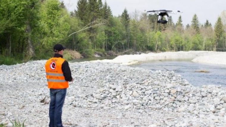
In order to assess the success of the measure in one to two years, the responsible Water Authority needs an accurate terrain model of the affected river section. Engineers at ING from Traunreut who were charged with the surveying, utilised the modern Aibot X6 multicopter, produced by the German company Aibotix, for data generation. For ING the fastest and best solution, said Markus Prechtl as a survey by GPS would not have worked because the satellite reception would have been shaded by the surrounding forest. A survey by tachymeter would have been necessary, which would have given them only individual cross sections and would also have taken at least three to four days to be completed. By contrast, with the Aibot X6 they could capture the whole site completely within a very short time.
With the hexacopter the entire route of 3.6km was flown twice: once with a video and once with a digital camera. With the video, they get a complete documentation of the actual state at the time of the aerial survey, said Prechtl. In two to three years, this can easily be compared with new recordings. The georeferenced images taken with the digital camera were processed after the flight to a detailed 3D model of the river section. River course and slope top are displayed in the model with a GSD of 2.5cm. Prechtl explained that the 3D model enables changes in the river to be traced in detail in the course of time.
Technical Details
-
Camera: Nikon Coolpix A
-
Sensor Resolution: 16.0 Megapixel
-
Flight altitude: 100m
-
Image overlap: 60% in all directions (left, right, front, back)
-
Ground resolution: 2.5cm
Data processing
-
Synchronisation of the GPS information with the images shot by Aerial Image Manager for a fast post-processing
-
Further processing with photogrammetry software Agisoft

Value staying current with geomatics?
Stay on the map with our expertly curated newsletters.
We provide educational insights, industry updates, and inspiring stories to help you learn, grow, and reach your full potential in your field. Don't miss out - subscribe today and ensure you're always informed, educated, and inspired.
Choose your newsletter(s)


