UAV Surveys Help Port of Rotterdam to Expand
Van Oord is using Marlyn Cobalt survey drones to ensure design conformance and increase safety at the Port of Rotterdam, the largest container port in Europe. The Dutch port is currently expanding its quays and retaining walls to increase its container transshipment capacity.
Container volumes in Rotterdam are expected to continue to increase strongly in the coming years. In order to further strengthen its leading position as Europe’s largest container port, the Port of Rotterdam Authority is investing in the further expansion of the Prinses Amaliahaven harbour located on Maasvlakte II. With a focus on construction sustainability and on minimizing the environmental impact, and together with HOCHTIEF and Ballast Nedam, Van Oord has begun the construction of approximately 2.4km of quays and retaining walls that will significantly increase the container transshipment capacity in Rotterdam.
Increasing Efficiency with UAV Monitoring
Building a new harbour comes with many challenges. Container quay construction requires sustainable, smart choices, so that the impact on the environment and nature is limited as much as possible. A project of this size requires the use of heavy equipment and a large number of employees at the construction site. Sustainable construction and safety are central during the implementation of the entire project.
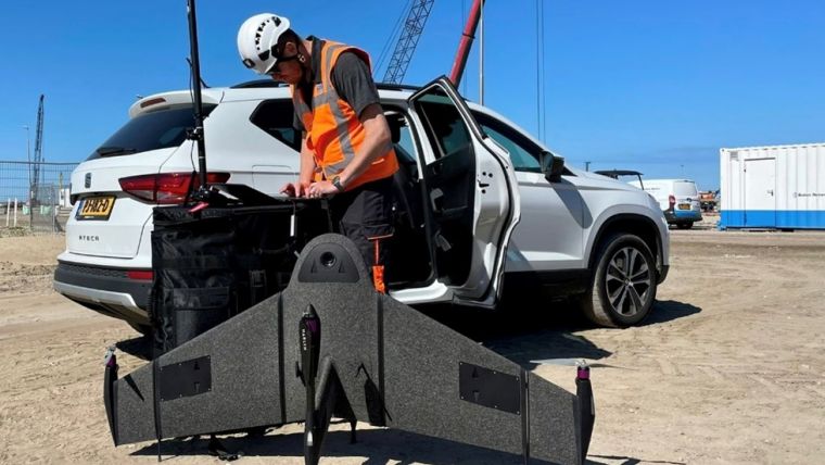
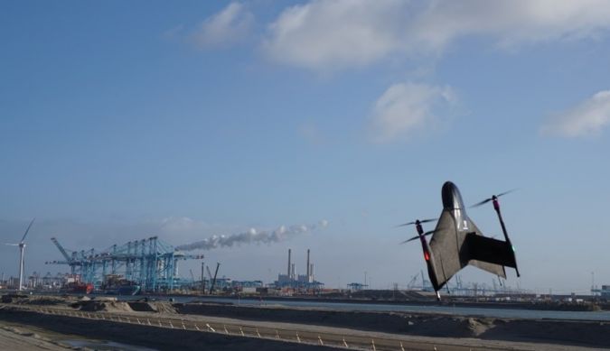
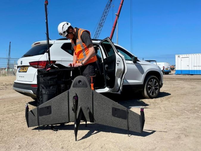
Unmanned aerial vehicles (UAVs or ‘drones’) can largely increase the efficiency in such projects while at the same time improving safety for the people involved. To ensure design conformance while keeping track of all the site development, Van Oord is using Marlyn Cobalt survey drones designed by Atmos to take accurate weekly snapshots for detailed progress monitoring.
This approach makes things much easier and faster for Van Oord’s surveying department compared to traditional surveying methods. The resulting orthophotos contain precise geospatial data that can be used to produce digital terrain models (DTMs) of the construction site at the port. “Marlyn gives us the possibility to capture ever greater project areas in more detail than before. A great tool to have!” said Frank Reynhout, a surveyor at Van Oord.

Value staying current with geomatics?
Stay on the map with our expertly curated newsletters.
We provide educational insights, industry updates, and inspiring stories to help you learn, grow, and reach your full potential in your field. Don't miss out - subscribe today and ensure you're always informed, educated, and inspired.
Choose your newsletter(s)


