UK Hydrographic Office Starts Seabed Mapping Surveys of the Falkland Waters
This article was originally published in Geomatics World.
In November, the UK Hydrographic Office (UKHO) will be conducting seabed mapping surveys of the Falkland Island coastal waters to support safe maritime trade and the development of a sustainable blue economy. The collection of hydrographic data is vital to supporting safe trade, sustainable economic growth and the protection of coastal communities from the effects of climate change, says the UKHO.
As part of the UK government’s Overseas Seabed Mapping Programme, the UKHO will lead the collection of this data through vessel-based seabed mapping surveys of the Falkland Island coastal waters. Data from these surveys will initially be used to update nautical charts to support safe and efficient navigation for ships using the Falkland Island waters.
Overseas Territories Seabed Mapping Programme
In the November/December issue of Hydro International, UKHO's Phil Payne talks about the Overseas Territories Seabed Mapping Programme. As Survey Delivery Manager, Payne is in charge of contracting out and organising surveys around the world, which his organization undertakes as part of the UK Government’s Commonwealth Marine Economies (CME) and Overseas Territories Seabed Mapping Programmes.
This forms part of the work carried out by the wider Hydrographic Programmes team to support blue economic growth and help territories to fulfil their international maritime safety obligations under the Safety of Life at Sea (SOLAS) Convention. "So far, we’ve covered more than 19,500km2 throughout these programmes and have conducted surveys in Commonwealth states across the Caribbean and Pacific to support sustainable economic growth and safe navigation”, Payne says.
Marine Environment
With the expected increase in expedition cruises within the waters around the Falklands, it is important that safe passage is achieved to the sites visited to minimize impact and reduce the risk of an incident occurring that impacts on not only human life, but could also have environmental consequences. Further data sets, such as seabed type, will be used to help the Directorate of Natural Resources preserve the marine environment and sustainably harness economic resources.
Kerrie Howard, Hydrographic Programme Manager at UKHO welcomed the survey, “A good understanding of the ocean is increasingly important in continuing to help island territories realise their economic potential. As Primary Charting Authority for the Falkland Islands, this programme gives UKHO the chance to survey the waters surrounding the islands and ensure that the territory is working towards fulfilling its international maritime safety obligations under the Safety of Life at Sea (SOLAS) Convention”.
Surveys will be conducted until the end of January using personnel from the UKHO and their contractor EGS. The team are using local vessel John Davis as the survey platform, along with two support vessels. This work is supported by the UK government’s Conflict, Stability and Security Fund, which has been established to build peace and stability around the world.
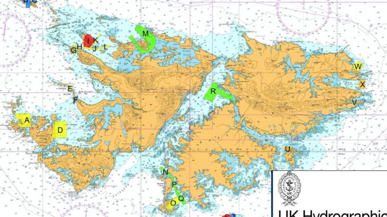
(Image: Data from the surveys will be used to update nautical charts to support safe and efficient navigation for ships using the Falkland Island waters. Image: UK Hydrographic Office)

Value staying current with geomatics?
Stay on the map with our expertly curated newsletters.
We provide educational insights, industry updates, and inspiring stories to help you learn, grow, and reach your full potential in your field. Don't miss out - subscribe today and ensure you're always informed, educated, and inspired.
Choose your newsletter(s)


