
Velodyne Lidar Signs Multi-Year Agreement with GreenValley
Velodyne Lidar has announced a multi-year agreement to provide its Lidar sensors to GreenValley International for handheld, mobile and unmanned aerial vehicle (UAV) 3D mapping solutions, including in GPS-denied environments. Velodyne is already shipping sensors to GreenValley as part of this agreement.
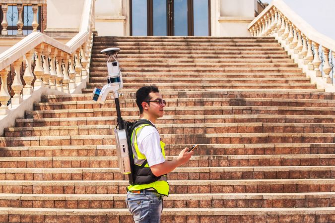
GreenValley uses Velodyne’s Puck Lidar sensors to provide perception and navigation capabilities that enable their systems to utilize simultaneous localization and mapping (SLAM) in their mobile mapping solutions. The ability to scan without GPS by using Lidar allows foresters, archaeologists, civil engineers and surveyors to build robust datasets without preparations ahead of time or complex post-processing software. Velodyne’s power-efficient, versatile sensors allow GreenValley to incorporate their technology into a variety of form factors, from backpacks to drones/UAVs to handheld mobile devices that can be used in a wide range of indoor and outdoor environments, regardless of temperature, lighting or precipitation.
Lidar for Aerial and Handheld Mapping Solutions
“Adopting Velodyne’s industry-leading Lidar sensors has enabled GreenValley to innovate and provide various industries with cutting-edge, reliable 3D mapping solutions,” said Qinghua Guo, CEO of GreenValley International. “Velodyne’s Lidar sensors currently power select models in our aerial and handheld mapping catalog. We have received extremely positive end user feedback, and we are excited about our future collaborations.”
“GreenValley is transforming various industries with its innovative and reliable Lidar-powered 3D mapping solutions,” said Ted Tewksbury, CEO of Velodyne Lidar. “Enabled by Velodyne’s Lidar sensors, GreenValley’s aerial and mobile mapping product catalogue has greatly improved data processing efficiency, saving time and reducing costs for customers worldwide.”
GreenValley has established itself as a leader in complete 3D surveying and mapping solutions. The company primirarly focuses on Lidar and image fusion technology, specializing in Lidar, UAV, SLAM, photogrammetry and other technologies to achieve an accurate digital representation of three-dimensional space.

Value staying current with geomatics?
Stay on the map with our expertly curated newsletters.
We provide educational insights, industry updates, and inspiring stories to help you learn, grow, and reach your full potential in your field. Don't miss out - subscribe today and ensure you're always informed, educated, and inspired.
Choose your newsletter(s)


