VeriDaaS Initiates Statewide Lidar Collection Project in California
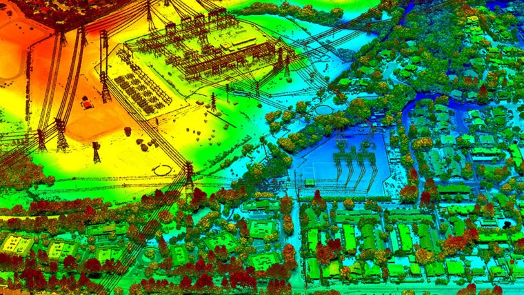
VeriDaaS has completed test flights necessary to begin its statewide mapping project in California, USA, by acquiring high-density Lidar elevation data on multiple areas of interest (AOIs). This data will be used for evaluation purposes by various state, federal and commercial stakeholders.
In April 2021, VeriDaaS collected data at a minimum of 30 points per metre on a number of AOIs, each with different terrain, vegetation and feature densities. These test flights will also be used to baseline sensor collection parameters to ensure the resulting data satisfies a wide range of use cases.
High-density data from higher altitudes
“We are confident that our data will meet and exceed the quality standards required by our targeted stakeholders,” said Christopher Payne, VeriDaaS CEO. “Our recent large-area project work in Arizona demonstrated that our Geiger-mode Lidar offering exceeds established accuracy specifications at unsurpassed speed and cost efficiencies,” Payne added. “We look forward to collecting the remainder of California as part of our National Mapping Initiative VeriMAP.”
The statewide California mapping project will support a wide range of use cases for both government and private enterprises. VeriDaaS continues to build out a coalition of private and public stakeholders to support funding of the project. This coalition will significantly lower the cost for all stakeholders while maximizing the return-on-investment and value of the data.
VeriDaaS is using its Geiger-mode Lidar sensor systems and multiple fixed-wing aircraft for this project. The Geiger-mode sensors are optimized for efficient collection of high-density data from higher altitudes while maintaining precision and accuracy over wide geographic areas. The elevation data collected will then be processed and classified to generate derived products and analytical information to support decision-makers across multiple vertical markets. VeriDaaS and its partner network will generate the derived products to meet the specific needs of users in each targeted vertical market.

Value staying current with geomatics?
Stay on the map with our expertly curated newsletters.
We provide educational insights, industry updates, and inspiring stories to help you learn, grow, and reach your full potential in your field. Don't miss out - subscribe today and ensure you're always informed, educated, and inspired.
Choose your newsletter(s)


