Vision 3D Put to Work in New Zealand
Excavation systems from MOBA Mobile Automation AG (Germany) are already being deployed in numerous countries throughout Europe. Now, the company's high-end system Vision 3D is for the first time being put to work on a construction site in New Zealand, where it has been in use since June 2012.
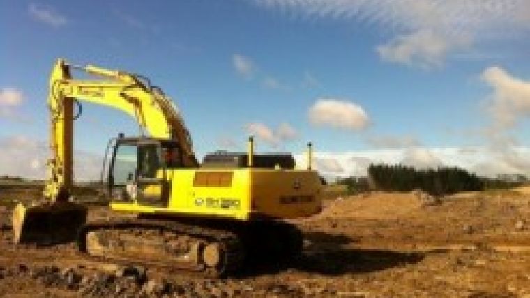
The system, in use for the first time in New Zealand, was mounted on a Sumitomo excavator near Auckland in the spring of 2012. The installation took about a week altogether, including training on the Sumitomo model DH 350. End-customer A & R Earthmovers Ltd. is deploying the excavator in multi-shift operation to build a new industrial site, with a size of roughly 200 hectares, close to New Zealand's largest city Auckland.
The project model created on a PC was supposed to be transferred to the machine. However, the volume of data was much too large for transmission via an Internet connection. This problem was solved by means of Telesupport, which is offered for the Vision 3D. Telesupport is a helpdesk making users able to directly interconnect to the system via wireless connections.
Telesupport reduced the volume of data of the model. As a result, the transfer to the machine and processing with Vision 3D were possible without any problems. The system accepts all common data formats, so time-consuming conversions are eliminated.
With the GNSS positioning, which is made more exact by using RTK (Real Time Kinematics), the precise position of the excavator and bucket is known at all times. This localisation via satellite enables high-precision, efficient work.
The position data, as well as the incline and height differences in relation to the reference area, are shown to the operator in real-time on the 8.4 inch display. On the basis of this display, the excavator operator can track the bucket in the 3D model and precisely steer it. With the visualisation of the work
steps, it is also possible to work precisely under water. The sturdy sensors that measure the incline angle on three axes are suitable for use under water as well.

Value staying current with geomatics?
Stay on the map with our expertly curated newsletters.
We provide educational insights, industry updates, and inspiring stories to help you learn, grow, and reach your full potential in your field. Don't miss out - subscribe today and ensure you're always informed, educated, and inspired.
Choose your newsletter(s)


