Washington Monument Height Updated with Latest Measurement Technology
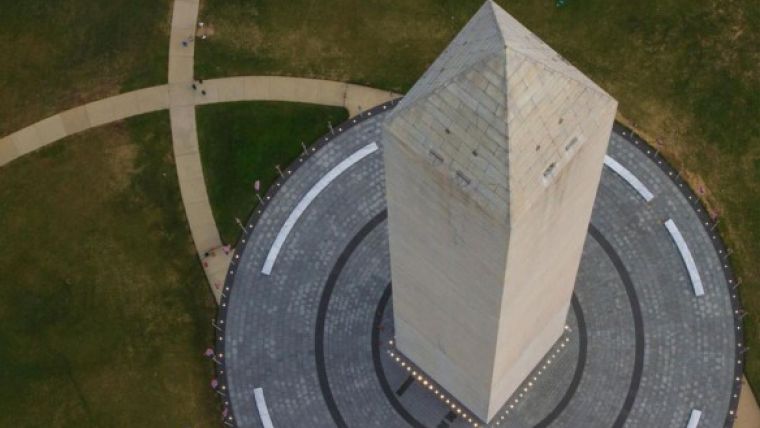
A unique view of the Washington Monument from the National Park Service. Using new international measurement standards and technology not available in the past, NOAA's National Geodetic Survey has calculated the official architectural height of the Washington Monument to be 169.05 metres, highly precise measurement that makes it eligible for inclusion in official registers of the world's tallest structures. NOAA's NGS provides the framework for all positioning activities in the United States.
The NGS measurement was made using measuring certification standards of the Council on Tall Buildings and Urban Habitats(CTBUH) and was finalised in December 2014. The final results were reported to the National Park Service in a report that will be available online beginning 17 February 2015.
Although the newly established architectural height differs from the historical height of 169.30 metres neither the starting point nor the so-called "standard deviation" used for the original 1884 measurement is known, making comparison of the two measurements difficult. The new architectural height provides baseline documentation that can be easily reproduced for comparison with future measurements and investigations to determine if the height of the monument is changing in any way.
Tallest structures
The new elevation standard meets the requirements to nominate the monument for inclusion on the register of the world's tallest structures as maintained by the CTBUH. The council recently certified the new One World Trade Center in New York City as the tallest building in the Western Hemisphere at 541.33 metres, and as the third tallest completed building in the world. The council provides the global measuring certification standards for official structure height.
Data gathered through science and technology are continually teaching us more about our planet and our history, said Kathryn Sullivan, under secretary of commerce for oceans and atmosphere and NOAA administrator. NOAA's National Geodetic Survey's authoritative spatial data, models, and tools are vital for the protection and management of our nation's natural and manmade resources. NOAA is pleased to join with the National Park Service in caring for special places like the Washington Monument and in discovering more about its treasures.
The National Park Service appreciates the results of the continued partnership with NOAA's National Geodetic Survey and look forward to fully evaluating the report's findings of the architectural height of the Washington Monument, said Karen Cucurullo, NPS acting superintendent of National Mall and Memorial Parks. The data from collaborative projects such as this provide us additional tools with which to track changes and plan appropriate measures for the long-term preservation of the monument.
Starting point
We have to be cautious in comparing this new height to the historic one, since we do not know precisely the actual starting point that U.S. Army Corps of Engineers Lt. Col. Thomas Casey used in 1884, said NOAA's Dru Smith, Ph.D., NOAA's chief geodesist. Today's elevation reflects the international standards for measurement of a building's height as well as considerable technological improvements.
With the earthquake repair scaffolding in place in 2012, NOAA and the NPS worked cooperatively to update the position of the peak of the monument – its latitude, longitude, and elevation – as well as to determine the architectural height of the building, a "base-to-tip" height that for the first time would meet modern international standards for building heights. The resulting architectural height of 169.05 metres is accurate to within plus or minus one millimetre. That variation is what is known as the "standard deviation" and can help explain the changing height estimates over the years.
No measurements are perfect, said Smith. What is important to know is how well that measurement has been made – the standard deviation. The standard deviation used in the original estimate of 169.29 metres is unknown, and the same goes for the actual starting point for the measurement.
It is the reference to an 3,175 mm that makes the original measurement so interesting, Smith said. Did the original builders think they had truly measured or estimated the height with sufficient accuracy to justify that couple of millimetres? The answer is unclear and at present remains lost to history. What we can now say with certainty is that the current height can be definitively stated to be within the standard deviation.
Markers
The 2013-14 survey and architectural height is the end result of a request from the NPS to determine if the 23 August 2011, earthquake had caused any unexpected settling of the Monument which suffered extensive cracking of its stonework. Based on a post-earthquake levelling survey done in 2012, NGS determined the earthquake had no discernible impact on the settlement of the Washington Monument.
As part of that same 2012 survey, NGS further found that the rate of settlement for the Washington Monument itself, based on multiple measurements taken since 1901, is about 0,5 millimetre per year. This indicates that the monument has settled just under 5.71 centimetres since 1901, none of which is attributable to the 2011 earthquake.
The just completed 2013-2014 survey included levelling to the base of the monument and verified the 2012 findings. However, the modern standard for measurement of the architectural height of the Monument refers to the height up to the tip of the monument measured from the actual floor point within the Monument itself, and not to a point or points on or below the ground around the building. The source of the original height may have come from four markers, dubbed "the Casey Marks" located in the ground a few feet off each of the Monument's corners that NGS discovered in its 1999 survey of the Monument which basically reconfirmed the Casey original report of 169.30 metres.
NGS in the latest survey also measured the height from those marks, which do not conform to the newer international standards for building elevation measures, and matched the 1885 height to within 19.1 millimetres. No other mark or marks on or near the monument comes as close as that to serving as a suitable "zero height." There remains, however, no historical evidence in anything Casey reported that he did indeed use those corner marks as his zero height point.

Value staying current with geomatics?
Stay on the map with our expertly curated newsletters.
We provide educational insights, industry updates, and inspiring stories to help you learn, grow, and reach your full potential in your field. Don't miss out - subscribe today and ensure you're always informed, educated, and inspired.
Choose your newsletter(s)


