Woolpert Earns US Patent for Topographic and Bathymetric Lidar Technologies
Woolpert has been granted a patent by the United States Patent and Trademark Office for its ‘Airborne Topo-Bathy Lidar System and Methods Thereof’. A Lidar sensor system was developed by a multidisciplinary research and development team incorporating these technologies that enable the collection of high-resolution topographic and bathymetric data at a higher altitude, resulting in a broader swath than previously developed Lidar systems.
“Commercially available airborne Lidar bathymetry systems currently operate at low altitudes, which are far below the altitudes of topographic Lidar systems,” Woolpert Lead Scientist Nathan Hopper said. “Increasing the operational altitude of airborne Lidar bathymetry systems to 10,000 feet presented several challenges that required novel approaches. This patent covers the proprietary technology developed to overcome the many challenges associated with high-altitude topography and bathymetry.”
Hybrid Approach and Reformatting Capabilities
The patent applies to the technologies that enable the Lidar system’s optical design, hybrid detector approaches and field of view management. For instance, reformatting hardware was invented to allow for the illumination of a full detector array, increasing the probability of detection. According to Hopper, the team’s primary design focus was to maximize the use of three wavelengths of light – 532, 647 and 1,064 nanometres – by distributing them into distinct detector channels designed for shallow water, deep water, Raman and topo. The infrared light is further split into a linear mode and Geiger-mode channel explicitly utilized for sea surface and topographic measurements. This hybrid approach coupled with reformatting capabilities supports increased spatial resolution and reduces vertical biases.
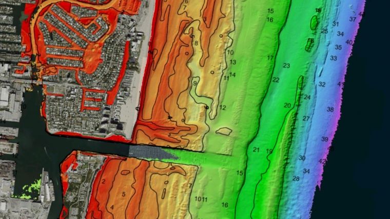
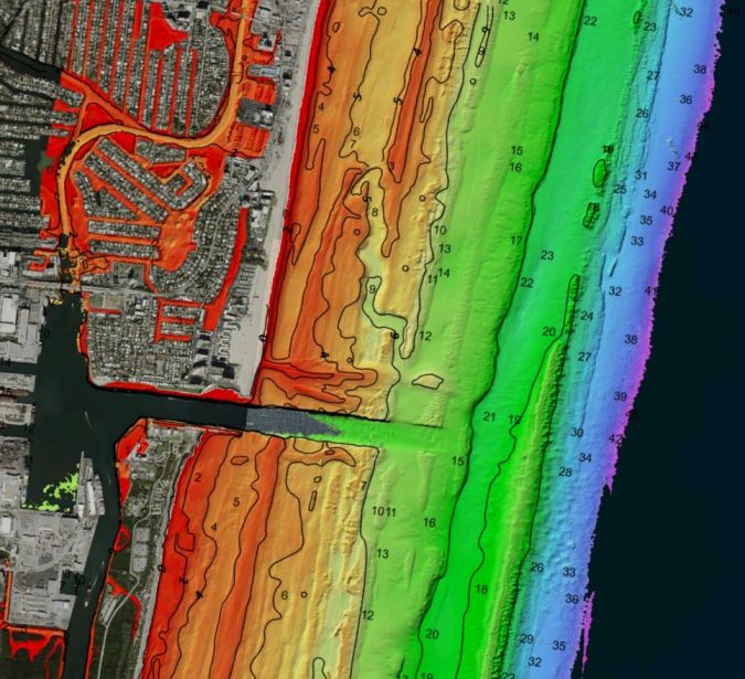
These technologies were born out of a need to equip the U.S. Army Corps of Engineers with the capability to collect greater detail over larger areas, as well as providing a more efficient, safe and cost-effective means of doing so. The research that went into the development of these technologies will not only support future sensor development efforts but will enable more efficient data collection for the Joint Airborne Lidar Bathymetry Technical Center of Expertise (JALBTCX), its partner organizations and Woolpert’s commercial clients. Coastline data from oceans, lakes and other waterways helps track erosion, monitor the environmental impact of natural disasters, perform volumetric studies, support sediment management, ensure safe navigation and port security, and drive economic development.
Woolpert began providing geospatial services in 1969 and conducted its first countywide topographic Lidar data collection in 2000. The firm has collected more than three million square miles of Lidar and imagery, owns and operates a fleet of aircraft and sensors, and has been contracted to test emerging Lidar technologies and the development of Lidar sensor systems.
The firm established a research and development lab in Bay St. Louis, Miss., assembled a team of engineers and scientists, and developed a high-altitude topo-bathy Lidar sensor system incorporating these patented technologies, the Bathymetric Unmanned Littoral Lidar for Operational GEOINT (BULLDOG).

Value staying current with geomatics?
Stay on the map with our expertly curated newsletters.
We provide educational insights, industry updates, and inspiring stories to help you learn, grow, and reach your full potential in your field. Don't miss out - subscribe today and ensure you're always informed, educated, and inspired.
Choose your newsletter(s)


