YellowScan Introduces New Point Visualization Cloud Software Module
YellowScan recently launched its software add-on module: Colorization. This third software module enhances the capability of CloudStation, YellowScan’s powerful data processing tool that provides users the ability to create and manipulate point cloud data from their Lidar surveys. YellowScan is one of today's leaders in UAV-Lidar solutions.
Understanding the importance of merging image-derived RGB colours with Lidar, YellowScan developed this new module following the same path as the other add-on modules, allowing for ease of use and enabling users to get results in only a few clicks. Made for the latest YellowScan Mapper camera hardware, it is also compatible for owners of a single camera package (Sony A6000 or A7R). The advantage of this new module being that the colourization process occurs directly inside CloudStation, saving time to generate the final output and making it easier to manipulate geospatial data.
How generating a colourized point-cloud works
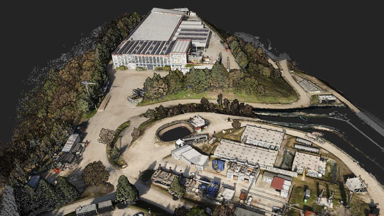
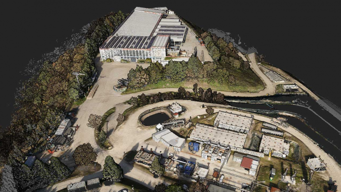
The Colorization module allows to combine the point cloud data you have generated from a flight and combine it with multiple photos taken simultaneously, thus generating a colourized point cloud. The colourization process automatically refines the camera alignment with the Lidar on a per-flight basis ensuring the quality of the final colourized product.
“We heard from numerous customers that being able to manage the colourization process from within CloudStation would be a big advantage. We feel this new module satisfies this request. We also felt it was important to build this with the active participation of our user community, so several client beta-testers worked with us to produce the final version to make sure we got it right,” stated Morgane Selve, product manager at YellowScan.
CloudStation and its other two add-on modules, Strip Adjustment and Terrain, are already available with the acquisition of a YellowScan Lidar solution and extend the effectiveness of other YellowScan solutions.

Value staying current with geomatics?
Stay on the map with our expertly curated newsletters.
We provide educational insights, industry updates, and inspiring stories to help you learn, grow, and reach your full potential in your field. Don't miss out - subscribe today and ensure you're always informed, educated, and inspired.
Choose your newsletter(s)


