Metrology is about highly accurate measurements for construction and engineering purposes. Where accuracies in traditional land surveying and topography are often on the mm to cm level and in marine surveying and bathymetry on the dm to m level, metrology brings those accuracies down to sub-millimeter level to allow constructions to be accurately engineered. An example underwater is the spool piece connection between a pipeline and a subsea platform or riser. 

Techniques used in metrology are often derived from standard techniques such as underwater acoustics positioning, total stations and level instruments but use versions that are more accurate or have measuring procedures that surpass those used in general surveying. 

Micrometre-level Deformation Monitoring of a Concrete Dam

Micrometre-level Deformation Monitoring of a Concrete Dam

Highly accurate measurements with a high temporal resolution have always been a challenge, especially for locations that are hard to reach since conventional geodetic deformation methods are often uns...

Laser Scanning in Deformation Measurements

Laser Scanning in Deformation Measurements

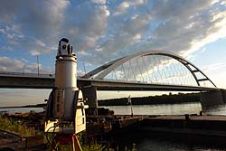
State-of-the-art geodetic and remote sensing techniques can prove their potential through particular engineering applications. Here we discuss load test measurements of bridges over the Danube. Prior ...