FLIR's US$200 Million Takeover of Aeryon Labs
FLIR Systems, the US-based global manufacturer of thermal imaging infrared cameras, has confirmed its takeover of the Canadian firm Aeryon Labs, a developer of high-performance unm...
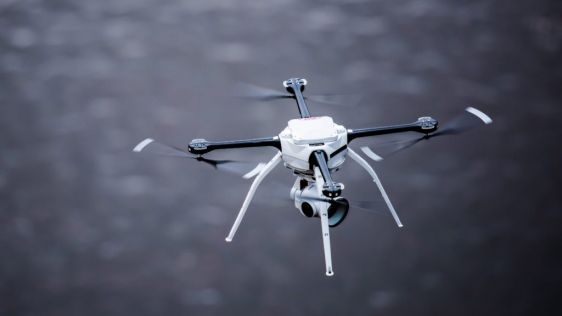
FLIR Systems, the US-based global manufacturer of thermal imaging infrared cameras, has confirmed its takeover of the Canadian firm Aeryon Labs, a developer of high-performance unm...

Drone start-up Atmos UAV has closed its next investment round with investment firm Disruptive Technology Ventures (DTV). Atmos has developed an industrial unmanned aerial vehicle (UAV or 'drone') that...

FLIR Systems Inc has announced the Black Hornet 3 nano-unmanned aerial vehicle (UAV) for use by global militaries, government agencies, and first responders. The Black Hornet Personal Reconnaissance ...

Klau Geomatics, specialised in post processed kinematic (PPK) direct georeferencing technology, has announced its new No-Base-Station high-accuracy georeferencing solution for unmanned aerial vehicl...

In early May 2018, the Czech company UpVision used an unmanned aerial vehicle (UAV) to map a copper mine in Mongolia – the largest in Asia – as part of an ongoing Czech geological expedition at th...

GNSS receiver manufacturer Septentrio has been selected to supply its high-precision AsteRx-m2 GNSS OEM receiver module and PPK library for use with Delair’s UX11 – a lightweight, BVLOS-ready fixe...

AEE Aviation Technology, a global leader in electric aviation and camera technology, has announced the introduction of the Mach 4, a multiple payload capable commercial UAV built to provide a best-in-...

The hybrid mapping UAV Marlyn, designed by ATMOS UAV, has enabled cartography professional TFC International to map the tropical island paradise of Silhouette Island, situated in the Indian Ocean. Thi...

Texo Drone Survey and Inspection (Texo DSI) have become the first company in the UK to take ownership of the Topcon Falcon 8+ UAV system. The UAV is the third generation edition of the Falcon Drone sy...

Topcon GB & Ireland has helped leading land and engineering surveying company, Murphy Surveys, expand its offering with the introduction of a specialised aerial survey division - MurphyUAV. By introdu...

Geomni, a Verisk Analytics business, has announced a new service that allows customers to dispatch a licensed, qualified UAV (unmanned aerial vehicle) pilot to collect imagery and data about a structu...
This site uses cookies. By continuing to use this website, you agree to our Cookies Policy. Agree