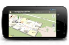
Indoor Positioning
Wouldn’t it be great if we could find our way around anywhere and at any time using a small in our hand, pocket or bag? What a relief it would be to know that we couldn’t get lost when arriving at...
Positioning is the accurate determination of the location of an object in space, relative to a framework or datum. In geographic / hydrographic information positioning is always present to determine the location of whatever we are measuring.
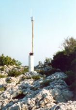
Depending on the type of application the framework can be global or local. When used globally techniques such as GNSS are used and the framework is defined by geodetical coordinate reference systems. Local positioning can be done on a jobsite such as in construction and engineering with total station but in for indoor navigation.

Wouldn’t it be great if we could find our way around anywhere and at any time using a small in our hand, pocket or bag? What a relief it would be to know that we couldn’t get lost when arriving at...
The effective seakeeping performance of any watercraft is vital for safe navigation. Due to the long maritime tradition in Greece, the National Technical University of Athens (NTUA) has been a key pla...

Thousands of people pass through Amsterdam Airport Schiphol in The Netherlands every day. Despite being one of the largest and busiest airports in the world, Schiphol strives to offer passengers a str...

I love to listen to tech podcasts that cover new gadgets or services. I’m not a big gadget person, but I love to think through the problem that a new product or service solves. I heard about some ne...
To date the visually impaired have received navigational aid from a wide range of technologies such as tactile maps, tactile graphic displays, acoustic devices, distance measurement by ultrasound or l...
Outdoor positioning and navigation techniques using GNSS have been well explored and are now a vital part of daily life all over the planet. Since GNSS was initially designed to support the military d...
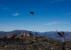
Lying in one of the most tectonically active zones in the Alpine-Himalayan belt, Iran frequently suffers from heavy and disastrous earthquakes. To monitor surface displacement and measure velocity and...
Whether for business or recreation, travel requires detailed planning. Prior to departure we can use the internet to search for directions to all the places we plan to visit. But how many of us take t...
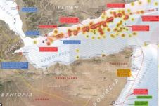
The Gulf of Aden is currently one of the world's most dangerous shipping routes. Pirates originating from Somalia, or rather that part of the country called Puntland, launch frequent attacks on comme...
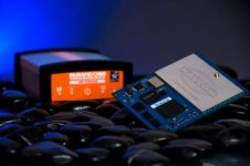
With spoofing attacks on the rise, survey-grade GNSS receivers need to be protected by interference mitigation technology utilizing the latest security techniques to ensure reliable positioning. The s...

'GIM International' spoke to Blickfeld, a developer of Lidar sensors and software, to hear about other potentially relevant applications in smart cities, besides for autonomous driving. Despite the n...
To increase capacity at Pangnirtung Airport, situated in a remote mountainous region of northern Canada, one solution could be to relocate the airport to one of two nearby sites. This article provides...

Read this interview with Topcon's Ulrich Hermanski for his views on the current status of the surveying profession, the key advances and the future role of surveyors. Since graduating in Geomatics Eng...
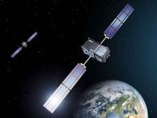
On 24 January 2023, the European Union declared the Galileo High Accuracy Service (HAS) operational for testing, and it is scheduled to become fully operational in 2024. This free signal adds precise...
NavCom Technology, Inc., a John Deere Company based in Torrance, California, USA, is a leading provider of advanced GNSS products for OEMs, VARs, and system integrators requiring high-performance RTK ...
This site uses cookies. By continuing to use this website, you agree to our Cookies Policy. Agree