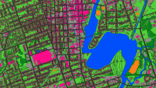
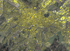
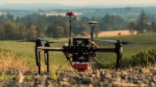
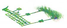
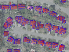
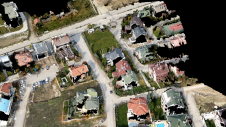
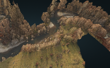
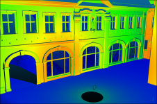
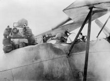
Mapping Radiation in Chernobyl
The use of UAV-Lidar is being tested in the complex terrain of the Chernobyl Exclusion Zone. The aim of the University of Bristol team is to demonstrate that, in the event of a nuclear incident, it co...
Remote sensing is all about gathering information on the earth using techniques that are ‘at a distance’ rather than touching the earth. Generally speaking remote sensing produces either point cloud data or imagery. The data is further processed using [geographical information systems] as part of [cartography].
Often Remote Sensing is differentiated by the type of platform or sensor used. Platforms can range from satellites through aircraft and drones to cars and ships. From a sensor perspective, Remote Sensing is a broad field that encompasses techniques such as [photogrammetry] and [lidar] but also [echosounding]. Often a form of ground truthing is required to transform the Remotely Sensed data into comprehensible products.
The use of UAV-Lidar is being tested in the complex terrain of the Chernobyl Exclusion Zone. The aim of the University of Bristol team is to demonstrate that, in the event of a nuclear incident, it co...
With a total length of 2,789km, the Trans-Sumatra Toll Road Project is one of Indonesia’s National Strategic Projects and the longest toll road project in Southeast Asia. In order to keep the projec...
An unprecedented scientific effort to Lidar-scan the entire surface of the Earth before it’s too late... that’s how Christopher Fisher, the founder of the Earth Archive, describes his initiative. ...
Airborne Lidar and 3D modelling technologies have emerged as highly valuable geospatial tools available to archaeologists in their efforts to gain insights into key historical sites. Being able to ac...
Geospatial mapping specialists and technology from GeoSLAM have been involved in a project to map the Lombrives cave in southern France. The Human Adaption Institute conducted a pioneering isolation e...
A new basemap combines 360-degree aerial imagery and precise location data, providing an immersive new way to view and experience the built world from every cardinal direction. Basemap imagery offerin...
In orthophoto projects of dense urban areas, true orthophotos are preferred over traditional orthophotos because they put building roofs into the correct horizontal position. However, there is still a...
A new algorithm has been developed that automatically identifies architectural elements and creates 3D models of building interiors. Over the last decade, the demand for digital twins has increased in...
RIEGL tested the performance of its topo-bathymetric airborne laser scanning system in a transition zone context along the French Mediterranean coast. Initially planned as a UAV survey, tests were con...
As the demand for elevation data continues to rise, it is important that users match the level of reliability, accuracy and resolution of the data to their specific application to arrive at an appropr...
DJI recently introduced the P4 multispectral, a high-precision unmanned aerial vehicle (UAV or ‘drone’) which exploits the integration of multispectral cameras to facilitate agricultural and envir...
The accuracy of coastline data in Indonesia could be much improved by making use of Lidar bathymetry technology. In this article, the authors describe how Lidar bathymetry survey techniques were appli...
In the past, the effort of hardware integration and the necessary combination of different software tools was a major hurdle to gain a foothold in the field of laser scanning. This hurdle has now been...
More than 40 companies have joined EAASI since the European aerial mapping industry created the not-for-profit umbrella organization aimed at fostering joint interests less than two years ago. In this...
Is it possible to enhance point cloud accuracy and density by merging Lidar with photogrammetry technologies? Lidar data can penetrate trees and measure shadow areas to produce a very accurate point c...
This site uses cookies. By continuing to use this website, you agree to our Cookies Policy. Agree