Towards a coastline base map in Indonesia
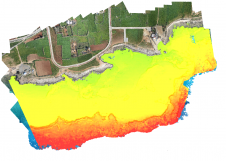
The accuracy of coastline data in Indonesia could be much improved by making use of Lidar bathymetry technology. In this article, the authors describe how Lidar bathymetry survey techniques were appli...

Remote sensing is all about gathering information on the earth using techniques that are ‘at a distance’ rather than touching the earth. Generally speaking remote sensing produces either point cloud data or imagery. The data is further processed using [geographical information systems] as part of [cartography].
Often Remote Sensing is differentiated by the type of platform or sensor used. Platforms can range from satellites through aircraft and drones to cars and ships. From a sensor perspective, Remote Sensing is a broad field that encompasses techniques such as [photogrammetry] and [lidar] but also [echosounding]. Often a form of ground truthing is required to transform the Remotely Sensed data into comprehensible products.
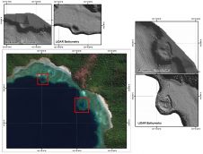
The accuracy of coastline data in Indonesia could be much improved by making use of Lidar bathymetry technology. In this article, the authors describe how Lidar bathymetry survey techniques were appli...
In the past, the effort of hardware integration and the necessary combination of different software tools was a major hurdle to gain a foothold in the field of laser scanning. This hurdle has now been...
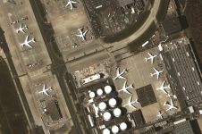
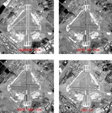
More than 40 companies have joined EAASI since the European aerial mapping industry created the not-for-profit umbrella organization aimed at fostering joint interests less than two years ago. In this...
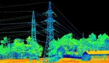
Is it possible to enhance point cloud accuracy and density by merging Lidar with photogrammetry technologies? Lidar data can penetrate trees and measure shadow areas to produce a very accurate point c...
Lidar technology is synonymous with 3D point clouds. To get the most out of 3D point cloud data, it is necessary to step back and continually consider the newest trends in Lidar technology and how the...
The technique known as structure from motion (SfM) has been suggested as a valid alternative to traditional photogrammetric methods. In a project in Glasgow, UK, an RTK-based point-to-point validation...
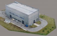
Modelling of urban areas, with emphasis on flat roof drainage calculations, is one application field in which the use of UAVs has significantly increased in recent years. A calibration base, built at ...
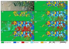
A recent study created crop type maps using Lidar, Sentinel-2 and aerial data along with several machine learning classification algorithms for differentiating four crop types in an intensively cultiv...
Remote sensing projects often begin with the question: 'Should I use aerial imagery or satellite imagery?'. During long-term projects, this question may arise again, particularly when unforeseen circu...

The possibilities of geoAI for monitoring Mother Nature are limitless according to Dr Nadina Galle, an ecological engineer and entrepreneur dedicated to applying emerging technologies. The use of sate...

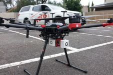
In this edition of ‘Ask the Specialist’ the question is: how can we unlock the full potential of drones for advanced mapping operations? For our ‘Ask the Specialist’ features, we invite reader...

Recent technological developments have made aerial surveying more exciting than ever. For imagery, ground resolutions of 2cm can now be reached, whereas for Lidar, pulse frequencies of 4GHz and point ...
Earth observation (EO) from space is important for resource monitoring and management. The performance of optical EO sensors is determined by four resolutions: spatial, spectral, radiometric and tempo...
What will be the future of Lidar? To quote Abraham Lincoln: “The most reliable way to predict the future is to create it”. So what is currently being created in the geospatial market? This article...
Accurate bathymetric mapping of shallow areas is essential for many offshore activities. Through Structure from Motion (SfM) and Multiview Stereo (MVS) techniques, images can provide a low-cost alter...
This site uses cookies. By continuing to use this website, you agree to our Cookies Policy. Agree