3D City Models
Abasabad in the north of Tehran has been designated a development area to serve the millions of people living in the metropolis. In order to progress from general zoning plan...
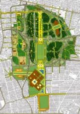
Abasabad in the north of Tehran has been designated a development area to serve the millions of people living in the metropolis. In order to progress from general zoning plan...
The ancient imperial city of Fez, Morocco, is an important tourist attraction and has been listed as a UNESCO World Heritage Site since 1981. The layout of the city is...
A new solution from GTA (Germany) and Procedural offers more 3D detail in modelling of large databases of real-world building data. Special focus is set to add depth to the...
A new product in the AVEVA Plant portfolio is AVEVA Laser Modeller, a 3D laser scanning software solution that can reduce by up to 50% the time for intelligent 3D...
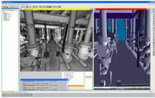
Three-dimensional documentation of heritage buildings is important for conservation, restoration and education. When it comes to complex architectural structures such as castles, no single modelling technique is capable of yielding...
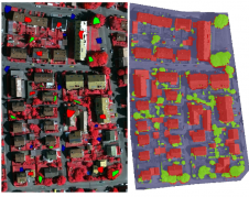
Planning, designing and managing the urban environment require appropriate decision-making. Here the availability and use of three-dimensional (3D) geo-information in the form of 3D city models is crucial. The authors...
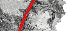
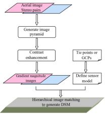
Thanks to rapid improvements in aerial laser scanning systems, they offer great potential in road surveying compared with traditional photogrammetry-based methods. Using the high-density 3D point clouds resulting from aerial...

Maxar Intelligence has been awarded a contract to supply the National Geospatial-Intelligence Agency (NGA) with a Precision3D Data Suite bundle. This comprehensive package covers an extensive area of 160,000 square...
This article outlines a generic workflow for automatic buidling detection and 3D modelling using modern technologies, to support applications ranging from urban planning and cadastre to change detection and navigation....
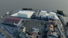
To explore the contribution of UAVs to the spatial mapping process in urban environments, a team from Greece studied the use of aerial imagery to achieve wide coverage of a...
This site uses cookies. By continuing to use this website, you agree to our Cookies Policy. Agree