Preview: UAV-g 2019
Unmanned aerial vehicles (UAVs or ‘drones’) have become popular instruments for a wide range of emerging applications such as mapping, search & rescue, infrastructure monitoring, precision farming, transport of goods...

Unmanned aerial vehicles (UAVs or ‘drones’) have become popular instruments for a wide range of emerging applications such as mapping, search & rescue, infrastructure monitoring, precision farming, transport of goods...
This issue of GIM International features breathtaking projects. The combination of challenging survey projects, technical innovations and stunning imagery makes it a must-read issue for mapping & surveying enthusiasts. Surveyors often have to carry out projects in harsh or remote environments. While this may not always be optimal for the land surveyors and other geomatics professionals involved, such projects...
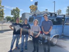
Calum G. Hoad is a graduate in Geography of the University of Aberdeen.

Inertial Labs has unveiled its latest innovation: high-precision three-axis accelerometers (TAA). These compact, self-contained devices mark a significant leap forward in navigation-grade accelerometers, promising unmatched precision in measuring linear accelerations....

Both vertical and oblique aerial images have their own advantages, making them valuable in different reality mapping applications. So how can you choose between the two? This comparison will help...
It can still be difficult to achieve centimetre-level accuracy in mobile mapping, especially in GNSS-denied or challenging areas such as in deep urban canyons, under foliage or through tunnels. However,...
PCI Geomatics (Canada) has announced the release and free availability of Geomatica GeoRaster Loader, a desktop product used to load image data and associated metadata into Oracle 10g and 11g....

In the rapidly evolving landscape of geospatial technology, the annual Trimble Dimensions gathering is a dependable beacon for the surveying and mapping fields, providing a panoramic view of the current...

In a groundbreaking collaboration, Genesys International and Survey of India (SOI) have formed a strategic alliance to create digital twins of major cities and towns. This partnership is aimed at...
This site uses cookies. By continuing to use this website, you agree to our Cookies Policy. Agree