GEO Business 2024: unlocking geospatial innovation at ExCeL London
GEO Business, the UK’s premier geospatial event, is celebrating its tenth anniversary when it returns to ExCeL London on 5 and 6 June 2024. This edition promises to be the...

GEO Business, the UK’s premier geospatial event, is celebrating its tenth anniversary when it returns to ExCeL London on 5 and 6 June 2024. This edition promises to be the...
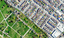
What are the primary technical differences between crewed and uncrewed aerial vehicles and satellites when it comes to capturing images of Earth? Where do they overlap, and where do they...
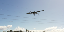
Fugro is teaming up with Australian UAV manufacturer Carbonix to establish a new long-range drone capability. It is Fugro’s first partnership working towards long-range beyond visual line of sight (BVLOS)...
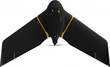
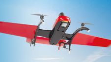
AgEagle’s eBee X series of fixed-wing UAVs are the first on the market to comply with the FAA's Category 3 of the 'Operations of Small Unmanned Aircraft Systems (sUAS) Over...
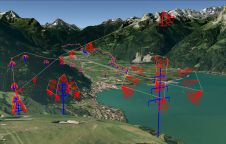
Mandatory asset inspection is crucial for utilities. Employees are often challenged with hard-to-access areas, heights or risky terrains. The traditional examination methods such as on-foot patrols, helicopters or industrial climbers...
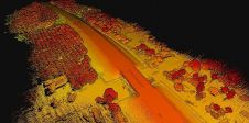
In a new partnership with YellowScan, FIXAR's flagship UAV model, the FIXAR 007, will be upgraded with a YellowScan Lidar system. YellowScan is one of the leading designers of next-generation...
With a total length of 2,789km, the Trans-Sumatra Toll Road Project is one of Indonesia’s National Strategic Projects and the longest toll road project in Southeast Asia. In order to...
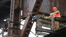
UAVs with a higher level of autonomy can make civil engineering inspections safer, faster and more accurate, plus they support the monitoring of infrastructural changes over time. The increasing development...

In this edition of ‘Ask the Specialist’ the question is: how can we unlock the full potential of drones for advanced mapping operations? For our ‘Ask the Specialist’ features, we...
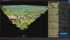
Switzerland-based photogrammetric leader Pix4D has announced the commercial release of Pix4Dmatic: digital photogrammetry software for accurate and fast corridor and large-scale mapping. Pix4Dmatic has been created to meet an evolving...
This site uses cookies. By continuing to use this website, you agree to our Cookies Policy. Agree