Five Hundred Years on and Still Exciting Times
It was 500 years ago that the Portuguese explorer Ferdinand Magellan organized a Spanish expedition to the East Indies that resulted in the first circumnavigation of the world. Sadly, he...

It was 500 years ago that the Portuguese explorer Ferdinand Magellan organized a Spanish expedition to the East Indies that resulted in the first circumnavigation of the world. Sadly, he...

Septentrio, a leader in high-precision GNSS technology, is teaming up with Point One Navigation, a provider of precise location as a service, for autonomous vehicle demonstrations during CES 2019 in...
Trimble has announced the launch of a new model of its Global Navigation Satellite System (GNSS) receiver, the Trimble R10 Model 2. Designed to help surveyors in a wide range...

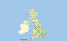
A short provision in the larger Islands Act bill passed by the Scottish Parliament in July 2018 now requires government mapmakers to put the Shetland Islands where it belongs. Tavish...

DJI, a world leader in civilian drones and aerial imaging technology, has announced the global rollout of the Phantom 4 RTK, a high-precision aerial survey drone that combines centimetre-level navigation...
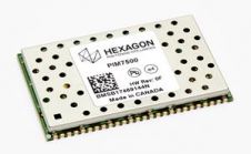
Hexagon’s Positioning Intelligence division has announced the PIM7500 Global Navigation Satellite System (GNSS) receiver explicitly designed for autonomous automotive platform development and solutions. This single-sided receiver features a compact form...

Geneq (SXblue) has introduced the SXblue ToolBox, the Android application for SXblue GNSS receivers. The application has been developed with special consideration to modern mobile device development and attention to...
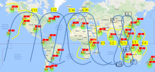
Currently there are four global navigation satellite systems (GNSSs) available: GPS, Glonass, BeiDou and Galileo. The satellites of these systems are used for positioning, and the accuracy is greatly improved...
Hemisphere GNSS has announced the multi-GNSS, multi-frequency 4-helix HA32 UAV antenna. The HA32 is a high-performance antenna that supports GPS, GLONASS, Galileo, BeiDou, Hemisphere’s own Atlas L-band correction service, and was designed specifically...
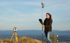
Ordnance Survey (OS) has just updated its geodetic infrastructure. Mark Greaves, Lead Consultant at Geodesy, describes these developments and takes a look at shorter and longer-term geodetic issues for surveyors....
This site uses cookies. By continuing to use this website, you agree to our Cookies Policy. Agree