Found 399 results
Sort by

A Visit to...Hewlett Packard Barcelona

Hewlett Packard (HP) celebrates the twentieth anniversary of its Barcelona site this year. The company has a portfolio spanning printing, personal computing, software, services and IT infrastructure, and Barcelona is...

Read more

Supporting the Construction Market

Datum Survey Products Ltd was formed in 1984 in Ossett, England by Paul Finney and Tim Long with the intention of creating a more affordable route into the construction survey...

Read more

Contex Releases Nextimage Software Solution

Contex has released Nextimage, a new generation multi-function software solution. The powerful software for wide format scanners makes scanning tasks faster with an intuitive user interface and advanced imaging features....

Read more

Jason-2 Successfully Launched

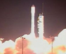
CNES and NASA have launched the Ocean Surface Topography Mission/Jason 2 satellite on 20th June from Vandenberg Air Force Base (CA, USA) on a globe-circling voyage to continue charting sea...

Read more

Leica PowerDigger

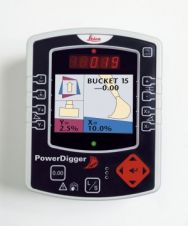
With the new Leica PowerDigger Excavator Guidance System, Leica Geosystems (Switzerland) presents its latest in a line of site proven guidance systems. Increased operator and machine productivity leading to reduced...

Read more

Carlson Survey 2009 Embedded AutoCAD

Carlson Software (KY, USA) has released Carlson Survey 2009 Embedded AutoCAD. This version has the AutoCAD OEM engine built-in, which is in addition to the Carlson Survey 2009 for AutoCAD...

Read more

Aerial Survey of the Maldives

The April 2008 issue of GIM International (page 11) summarised a project to map the Maldives as an example of how aerial photogrammetry is today applied for mapping large, complex...

Read more

Landslide Vulnerability

Geo-information technologies (GeoIT) play an important role in all phases of the risk-management chain in hazards such as flood, forest fire, windstorm, earthquake, volcano and landslide. The application of GeoIT...

Read more

GeoEye-1 Satellite Launch Successful

GeoEye has successfully launched GeoEye-1, the world's highest resolution, commercial Earth-imaging satellite. GeoEye's ground station in Norway relayed the downlink signal it received rom GeoEye-1 confirming that the satellite successfully...

Read more

Intergeo 2008 Preview

More than five hundred exhibitors from 32 countries are due to put in an appearance at Intergeo 2008, presenting a comprehensive overview of the geo(infor)matics business today. Covering a wide...

Read more