Calibration and mobilisation

The International Society for Photogrammetry and Remote Sensing is a non-governmental organization devoted to the development of international cooperation for the advancement of photogrammetry and remote sensing and their applications....
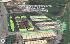
This study in Malaysia explores the use of sensor-acquired 3D point clouds as the basis for high-quality visualizations for the smart city subsurface. 3D city models are used as the...
Tersus GNSS has been awarded a major order for 185 Oscar GNSS receivers in Nigeria. This order will further strengthen the position of Tersus in Africa. Tersus has also been...
Trimble has announced enhancements to its industry- leading Trimble RTX correction services, tailored to meet the evolving needs of geospatial professionals. As part of an ongoing strategy to deliver premier...
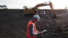
During the early days of Global Positioning System (GPS) technology in the 1980s and 1990s, surveyors had to chase satellite geometry and spend long hours collecting data in order to...

OxTS has grown rapidly over the last few years and we are looking for distributors to join our network. At OxTS, we have dedicated ourselves to developing industry-leading GNSS-aided inertial navigation technology. Since 1998, our products have been used and trusted world-wide for all applications where reliable, continuous position information as well as highly precise orientation data matter. Our successful business model has always been our inhouse expertise combined with that of our valued channel partners/distributors. Succeed With Confidence As Part of OxTS' Global Network OxTS has grown rapidly over the last few years and we are looking for distributors to join our network. At OxTS,...

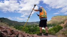
An inertial navigation system (INS) is a critical part of a surveyor’s armoury. The measurements provided by the INS, including heading, pitch/roll, timing and absolute position, ensure that surveyors can confidently measure their environment, safe in the knowledge that every area and angle is covered precisely. An inertial navigation system (INS) is a critical part of a surveyor’s armoury. The measurements provided by the INS, including heading, pitch/roll, timing and absolute position, ensure that surveyors can...
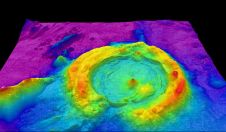
Bathymetric Lidar is a technique that is used to capture geospatial data of coastlines and waterbodies. The method has the potential to facilitate the fast and efficient creation of hydrographic data, and more...
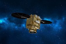
The first satellite of the Pléiades Neo constellation was safely delivered in orbit by Arianespace’s European launcher Vega, from French Guiana on 29 April. The constellation will comprise four very-high-resolution...
This site uses cookies. By continuing to use this website, you agree to our Cookies Policy. Agree