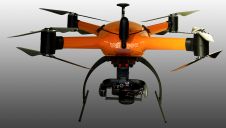
Usage of UAVs for flat roof drainage calculations
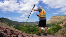
Modelling of urban areas, with emphasis on flat roof drainage calculations, is one application field in which the use of UAVs has significantly increased in recent years. A calibration base,...
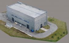
Modelling of urban areas, with emphasis on flat roof drainage calculations, is one application field in which the use of UAVs has significantly increased in recent years. A calibration base,...
BAM Infra recorded 3D road models using a Faro terrestrial laser scanner with the innovative BeeMobile mobile mapping system at various locations across the Netherlands in 2020. BAM Infra is part of...

RIEGL USA has announced its relocation to a new state-of-the-art, RIEGL Group-financed North American headquarters and training centre in Winter Garden, Florida. This investment was made possible by the continued success...
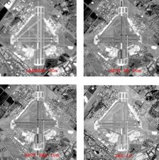
Earth observation (EO) from space is important for resource monitoring and management. The performance of optical EO sensors is determined by four resolutions: spatial, spectral, radiometric and temporal. In this...
When it comes to 3D modelling for construction, what are the advantages and disadvantages of photogrammetry versus Lidar in terms of accuracy, complexity and cost? Breaking away from laser measurement...
With the new release of the Condor V8-PPK mapping drone, Munich-based Videographics Ingenieurgesellschaft has completed its toolbox for most precise photogrammetric aerial mapping and surveying projects. The German company Videographics...
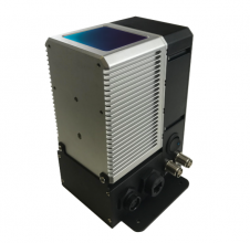
PolyExplore has launched the Polyscanner LS1, a high-precision Lidar mapping system designed for UAVs and other aerial platforms. Based around advanced solid-state Lidar technology, the Polyscanner LS1 uses an innovative...
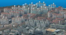
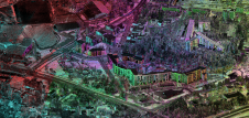
Around the world, local governments are rolling out Smart City/Digital Twin projects to support economic stimulation and tourism programmes and to improve the quality of life overall. Up-to-date 3D building...
How can kinematic laser scanning support urban planning and infrastructure management? Urbanization and the development of megacities is posing critical challenges for sustainable but efficient land use globally. Power lines,...
Trimble has introduced the Trimble R12i GNSS receiver, the latest addition to its Global Navigation Satellite System (GNSS) portfolio. The Trimble R12i incorporates Inertial Measurement Unit (IMU)-based tilt compensation using...
This site uses cookies. By continuing to use this website, you agree to our Cookies Policy. Agree