Monitoring Mountain Glaciers with TanDEM-X Radar Satellites
It is important to keep a watchful eye on glacial melt to avoid the sudden collapse of glaciers leading to tragedy, such as happened at the Marmolada glacier in the...

It is important to keep a watchful eye on glacial melt to avoid the sudden collapse of glaciers leading to tragedy, such as happened at the Marmolada glacier in the...
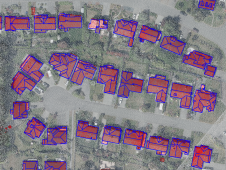
How can artificial intelligence and deep learning lead to a robust process for 3D city modelling? And what are some of the challenges? Automated classification and object detection in Lidar...
Airbus has released an online interface that allows customers to directly task the radar satellites and access the comprehensive 15-year radar archive. In late June, users will also be able...
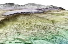
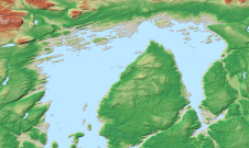
High-resolution topographic data reveals new faults, landslides, hydrothermal systems and volcanic features never documented before. Able to see through vegetation, Lidar maps the bare earth, unveiling the impact of past events...
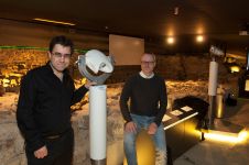
The Terra Mosana project is reinforcing the shared history in the territory where Germany, Belgium and the Netherlands meet. Today’s official country borders are relatively new, and geomatics can be...

How accurate is accurate enough? If you’re like most land surveyors, the answer is “as much as possible.” With an RTK drone, surveyors and other drone pilots can expect centimetre-level...

For consistent and precise digital GIS and photogrammetry workflows, raw data must first be converted into integrable and thus valuable information components that meet the requirements of the respective application...

Airbus and Japanese geospatial solutions provider PASCO have signed a new partnership agreement for a Pléiades Neo Direct Receiving Station (DRS) with associated data distribution rights on the Japanese market....
Surveyors and GIS professionals have the highest standards when it comes to their tools and trade. It is therefore no wonder that many surveyors are turning to drones for their mapping and...
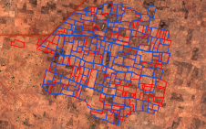
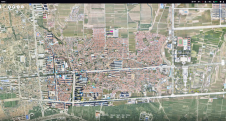
A special issue of the 'Land' journal highlights the latest Fit-For-Purpose Land Administration innovations, demonstrating that FFPLA is increasingly gaining momentum and acceptance. The Fit-For-Purpose Land Administration approach, which was...
This site uses cookies. By continuing to use this website, you agree to our Cookies Policy. Agree