Limitless Possibilities of UAVs Accelerate Growth
Unmanned planes are increasingly securing their place in the civilian world and are recognised as a valuable tool for surveying and mapping purposes. Whether used for agriculture, the oil sector...
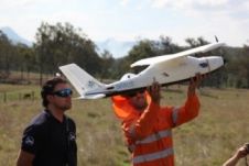
Unmanned planes are increasingly securing their place in the civilian world and are recognised as a valuable tool for surveying and mapping purposes. Whether used for agriculture, the oil sector...
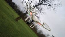
The use of Unmanned Aerial Vehicles (UAVs) as serious remote sensing platforms is a growing trend. They are already used in fields such as archaeology, construction, disaster relief, and the...
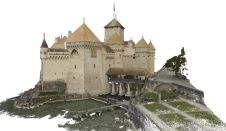
Pix4D has created a highly accurate and very dense 3D model of Chillon Castle (Château de Chillon), Switzerland’s most visited historic monument. The 3D point cloud integrates the indoor and...
Over the past two decades, airborne Lidar has evolved from a developmental technology into a well-established mapping solution, and in the process has revolutionised the surveying and mapping industry. Today,...
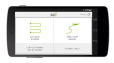
Making use of DJI’s new DJI Phantom software development kit, Pix4D has developed the first mapping app: the Pix4Dmapper mobile app allows drones such as DJI Phantom 2 Vision to...
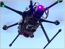
Siteco Informatica has launched its new high-performance Sky-Scanner Lidar and image data collection system for unmanned aerial vehicles (UAVs). In development since early 2015, the Sky-Scanner has already exceeded all...
With the boom in the use of consumer-grade cameras on unmanned aerial vehicles (UAVs) for surveying and photogrammetric applications, this article seeks to review a range of different cameras and...
The Compass family of businesses has introduced CompassDrone to provide airframes, software, services and support to geospatial professionals for UAS remote-sensing data collection. For industrial drone-based imagery, point cloud or...
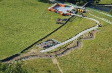
Structure-from-Motion photogrammetry and GIS are being used to chart the success of a river restoration project in Northern England. Many of the world’s rivers are degraded as a result of...
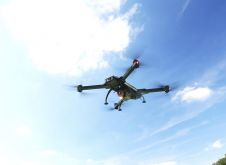
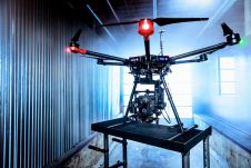
One of the most eye-catching developments in the surveying profession is the integration of unmanned aerial systems (UASs) and Lidar. Airborne laser mapping is no longer restricted to traditional aircraft only,...
This site uses cookies. By continuing to use this website, you agree to our Cookies Policy. Agree