Using the Apache Unmanned Survey Vessel
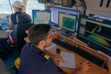
This paper explores the various features of the Apache USV series for efficient seafloor-level mapping. The CHCNAV hydrographic survey software is used for data recording and analysis. It provides results...
This paper explores the various features of the Apache USV series for efficient seafloor-level mapping. The CHCNAV hydrographic survey software is used for data recording and analysis. It provides results...
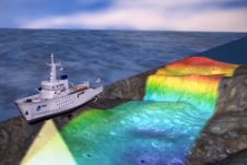
According to NOAA (The U.S. National Oceanic and Atmospheric Administration), hydrography is the science that measures and describes the physical features of the navigable portion of the Earth's surface and...
Three new global initiatives for mapping the world’s entire ocean floor have been announced in London at a special conference organised by The Nippon Foundation-GEBCO Seabed 2030 Project, the international...
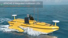
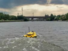
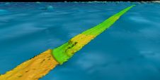
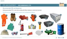
The APACHE6 unmanned surface vehicle (USV) is an innovative fully integrated solution for 3D bathymetric surveying, underwater object positioning, offshore construction, underwater archaeology and wreck rescues. Built around a triple-hulled...
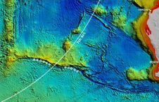
Fugro recently contributed more than 110,000 square kilometres of high-resolution bathymetry data in the North Atlantic Ocean to help improve the quality and coverage of seabed mapping in the region....
While 70% of the Earth is covered by water, very little of it has been surveyed so far (Mars, Venus and the Moon are better surveyed). The techniques for doing so...
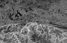
Australia’s first naval submarine, HMAS AE1, has been discovered 103 years after its disappearance during WWI. It was lost off the coast of Papua New Guinea on 14 September 1914....
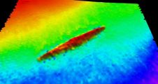
A new chapter in the search for Malaysia Airlines flight MH370 has begun with the announcement of Texas-based firm Ocean Infinity being hired to locate the missing wreckage. They could...
It is now well over ten years since Fugro Academy opened its doors within Fugro as a focal point for learning and development for the company’s 10,000-plus employees, who specialise...
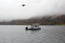
What is the best way to generate a high-precision 3D model to estimate the storage capacity of a lake that is surrounded by mountains? Rapid weather changes, low clouds and...
This site uses cookies. By continuing to use this website, you agree to our Cookies Policy. Agree