Urs Hugentobler
Urs Hugentobler is a professor of Satellite Geodesy and heads the Satellite Geodesy Research Facility of the Technical University of Munich, which operates the Geodetic Observatory Wettzell together with the...

Urs Hugentobler is a professor of Satellite Geodesy and heads the Satellite Geodesy Research Facility of the Technical University of Munich, which operates the Geodetic Observatory Wettzell together with the...

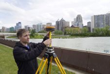
Global reference systems such as the International Terrestrial Reference Frame provide the foundation for determining positions on Earth and in space, as well as for reliably quantifying our planet’s changes...

Lidaretto is flexible and compact Lidar scanning system developed since 2015 and uniquely designed to be used the way that fits best to users’ specific application. You can easily mount...

Harxon demonstrated its dedication to innovation at Intergeo 2023 by introducing two products designed to advance high-accuracy positioning within the geospatial industry: the Survey GNSS Antenna (HX-CSX600A) and the Helix...
CNH Industrial has successfully concluded its acquisition of Hemisphere GNSS, a globally recognized leader in satellite navigation technology. This strategic purchase, valued at US$175 million and initially disclosed on 30...
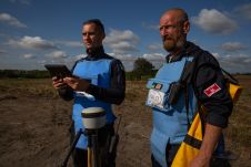
Trimble has announced a partnership with the HALO Trust, the world’s largest landmine-clearing non-profit organization, to help expand its demining operations across Ukraine. The grant from the Trimble Foundation Fund...
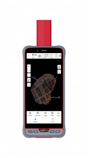
ComNav Technology has introduced its new handheld P6H. This advanced and rugged device is tailor-made for GIS data collection and outdoor operations. Featuring a GNSS high-precision positioning module, rugged IP67-rated...
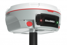
The Mars Pro Laser RTK is the third addition to ComNav’s Universe series of GNSS receivers, following on from the Venus Laser RTK and Mars Laser RTK. According to ComNav...
This site uses cookies. By continuing to use this website, you agree to our Cookies Policy. Agree