Combining precision and power: the Mars Pro GNSS receiver
The Mars Pro Laser RTK is the third addition to ComNav’s Universe series of GNSS receivers, following on from the Venus Laser RTK and Mars Laser RTK. According to ComNav...
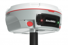
The Mars Pro Laser RTK is the third addition to ComNav’s Universe series of GNSS receivers, following on from the Venus Laser RTK and Mars Laser RTK. According to ComNav...
Our fast-changing world demands aerial cameras that are more productive, versatile and cost effective. The WARP Omni convertible camera is engineered to be highly competitive with satellite and UAV imaging, allowing you to leverage your expertise in aerial mapping for a broader range of applications. Our fast-changing world demands aerial cameras that are more productive, versatile and cost effective. The WARP Omni convertible camera is engineered to be highly competitive with satellite and UAV imaging,...
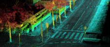
Ordnance Survey, the national mapping agency for Great Britain, was in need of a faster and more cost-effective way to collect georeferenced point cloud data, because the existing method was not sustainable in the long term. The Ordnance Survey team turned to Datron Technology and OxTS to help them develop a convenient, low-cost, ‘off-the-shelf’ mobile mapping system. Ordnance Survey, the national mapping agency for Great Britain, was in need of a faster and more cost-effective way to collect georeferenced point cloud data, because the existing method was...
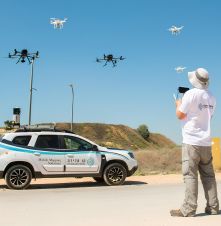
Israel’s national roads company is embarking on a large-scale, multi-year project to digitize its entire network. Surveying company Kav Medida has been awarded the contract to map the northern half...

In the early days of surveying, surveyors were pioneers in charting the unknown. Today, with the Earth having been completely mapped to some degree, surveying has become a much more...

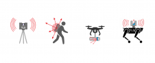
What are the primary technical differences between crewed and uncrewed aerial vehicles and satellites when it comes to capturing images of Earth? Where do they overlap, and where do they...
Over the centuries, all four industrial revolutions have influenced surveying instruments and the profession as a whole. This article explores which different skills and capabilities surveyors are required to develop...
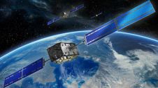
Galileo has begun the delivery of its High Accuracy Service (HAS), as officially announced by Thierry Breton, European Commissioner for the Internal Market. He described HAS as “feeding a prosperous market...
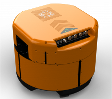
ComNav Technology has launched a laser GNSS receiver which enables rodless surveys – the Venus Laser RTK – as part of its new Universe series of GNSS receivers. Surveyors in the...
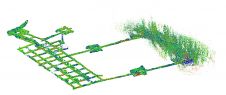
Read how SLAM technology was used to scan a former mine complex in Poland to ensure safety during a project to preserve the site's historical, educational and functional significance. Underground cultural...
This site uses cookies. By continuing to use this website, you agree to our Cookies Policy. Agree