China to Launch Civil HD Survey Satellite
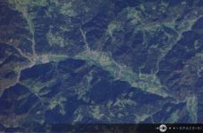
China will put into space a civil high-definition survey satellite, the first of its kind in the country, in 2011, the State Bureau of Surveying and Mapping (SBSM) said here...
China will put into space a civil high-definition survey satellite, the first of its kind in the country, in 2011, the State Bureau of Surveying and Mapping (SBSM) said here...

The IP-S2 HD Mapping System is a vehicle-mounted surveying and mapping system featuring a high-definition Lidar scanner from Velodyne Lidar. The IP-S2 HD Mapping System incorporates Velodyne's HDL-64E S2.2 Lidar...

A man who received a 360-degree camera as a gift has taken it upon himself to incorporate his neighbourhood in Guernsey into the Google Street View online map, according to...
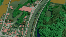
Innovative methodologies based on artificial intelligence (AI) are lowering the barriers and democratizing the use of 3D digital twins in the geospatial industry. Digital twins are revolutionizing the geospatial industry,...
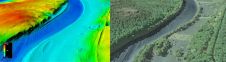
The US Geological Survey (USGS) and Dewberry have jointly released a new topobathymetric Lidar dataset for the Potomac River, extending from the Potomac Highlands in West Virginia to the Chesapeake...

The discovery of an old atlas with hand-sketched maps of Liberia’s capital, Monrovia, could become the basis for a unique digital cadastre. Since Liberia is a country that largely lacks...
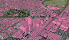
Ecopia AI and Woolpert have expanded their partnership to map Australia’s top metropolitan areas in 3D. The resulting vector maps will provide Woolpert’s Asia-Pacific clients with a detailed, accurate and...
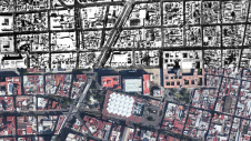
Over the past 15 years, geospatial information has enabled the transformation of towns, cities and a whole state in Mexico. The customer and data provider teamed up to create up-to-date...
The Slovenian Centre of Excellence for Space Sciences and Technologies (Space-SI) released the first multispectral image captured by its NEMO-HD Earth observation microsatellite just 16 days after launch. Built by...
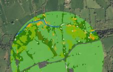
The UK’s Peak District National Park Authority is pioneering the use of artificial intelligence (AI) to automate the production of highly detailed land cover maps, in a project in partnership...
This site uses cookies. By continuing to use this website, you agree to our Cookies Policy. Agree