Found 70 results
Sort by

GeoM Improves Aerial Mapping Accuracy

South African GeoM (formerly Geomatica) has invested in a navigation system designed to improve the locational accuracy and reliability of aerial survey data. The purchase of a 5th-generation Computer Controlled...

Read more

Uniting Aviation with Data

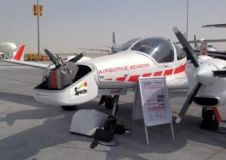
The Austrian company Airborne Technologies is specialised in two business fields: sensor integration/aircraft modification, and data acquisition/data processing. With its own fleet of multi-mission aircraft and data processing systems, Airborne...

Read more

Digital Oblique Aerial Cameras (2)

In recent years, aerial photogrammetry has increasingly been using camera systems which capture nadir and oblique images at the same time. The number of oblique systems on offer in the...

Read more