Leica FPES v10.1
Leica Flight Planning & Evaluation Software (FPES) v10.1 allows a fast and automatic load of DTM data with sophisticated computation capabilities. Beside many other enhancements Leica FPES v10.1 supports Windows...
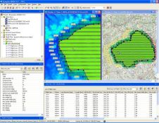
Leica Flight Planning & Evaluation Software (FPES) v10.1 allows a fast and automatic load of DTM data with sophisticated computation capabilities. Beside many other enhancements Leica FPES v10.1 supports Windows...
The new version of Leica Geosystem's IPAS GNSS-IMU processing software is designed to improve flight economy and simplify GNSS-IMU processing.The package allows to economise airborne data acquisition by up to...

Leica Geosystems' Leica Zeno GIS products within the Leica Viva family targeting the data collection market is available. These new handhelds provides a one-click automated workflow between the field and...
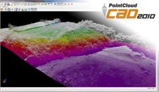
Based on rapid growth of High-Definition Surveying (HDS) in civil/survey mapping applications, Leica Geosystems and MicroSurvey Software announced plans at SPAR 2010 for Leica Geosystems to resell MicroSurvey's new PointCloud...

Leica Viva is a new generation surveying system that combines the latest technologies into an unrivalled portfolio of total stations, GNSS receivers, controllers and onboard software. Encompassing innovative, feature rich...
COADE and Leica Geosystems announced at the daratechPLANT2009 conference an agreement under which COADE will resell Leica Geosystems' CloudWorx Basic software. CloudWorx, in conjunction with COADE CADWorx fieldPipe for CloudWorx,...

General construction, machine control or agriculture - The Leica Rugby 320SG, 410DG and 420DG automatic and self-leveling Grade Lasers are the perfect tool. Their features ensure both material and labor...
Four independent Global Navigation Satellite Systems (GNSS) will be operational within the near future. With the new Leica GPS1200+ users can be certain that they are ready. The Leica GPS1200+...
The CI-14 CAT Interface Module from Leica Geosystems is designed to simplify and reduce cost of installation of Leica Geosystems 2D & 3D machine control systems on modern Caterpillar earthmoving...

Leica Geosystems (Switzerland) has launched GeoMoS Web, Leica's advanced and attractive software for TPS and GNSS monitoring. Each authorised user, including customers and partners, can access the monitoring project anywhere...
This site uses cookies. By continuing to use this website, you agree to our Cookies Policy. Agree