Laser Scan Data Used to Model Racing Circuit for Video Game
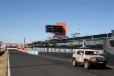
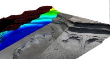
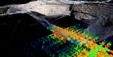
In late 2012, Maptek was asked to model Mount Panorama in New South Wales, Australia, for a video game. This marked the first time the game developer had used laser...
In late 2012, Maptek was asked to model Mount Panorama in New South Wales, Australia, for a video game. This marked the first time the game developer had used laser...
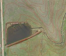
Collecting and processing point clouds has been trending topic in the geospatial sector over the past few years. This article focuses on point cloud processing software aimed at creating DEMs...
Landpro, New Zealand, has been using a UAV to deliver better survey value to mining, quarry and land development clients in Australia and New Zealand. The company acquired a Topodrone-100...
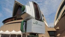
Maptek previewed the soon-to-be-released I-Site 8820 long range laser scanner on day 1 of the Australian Institute of Mine Surveyors (AIMS) conference in Sydney, Australia. Special features of this model...
Survey technology developer Maptek is demonstrating the workflow of I-Site Studio software for processing and modelling airborne data at this week’s International Lidar Mapping Forum in Denver, Colorado, USA. Datasets...
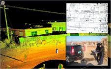
South-Australian company Redstack, a provider of service and technology to the engineering and architectural community, has formed alliances with local partners Maptek and Avitus UAV Systems to deliver end-to-end reality...
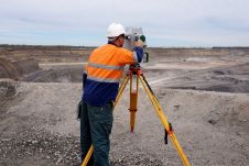
What is the current status of surveying in the mining industry, and which types of survey equipment and technologies are being used today? Geospatial data forms the foundation of mining....
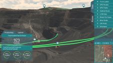
Digital twinning is based on the idea that a digital informational construct of a physical system can be created as a separate entity. The digital information is a ‘twin’ of...
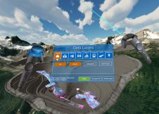
Mining technology developer Maptek and augmented reality experts LlamaZOO are teaming up together to bring digital twinning and advanced 3D data visualisation to the mining industry. LlamaZOO Interactive is an...
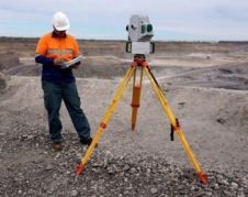
Terrestrial laser scanners were introduced to the mining industry as a smart tool for surveyors – a high-technology method for obtaining data more quickly and safely than previous methods. In...
This site uses cookies. By continuing to use this website, you agree to our Cookies Policy. Agree