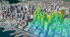
Geospatial digital twins will make cities smarter
Thanks to the ability of digital twins to provide insights into the reality of present conditions and the impacts of future scenarios, they have the potential to revolutionize the planning...
Thanks to the ability of digital twins to provide insights into the reality of present conditions and the impacts of future scenarios, they have the potential to revolutionize the planning...
In this exclusive interview, two of the driving forces behind this year's Intergeo talk about the event's evolution and impact, nurturing talent, land surveying, Earth observation and the Blue Economy....
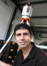
UK-based laser scanning specialist 3D Laser Mapping has embarked on a research project, in partnership with Durham University, following the award of a share of a multi-million pound government grant....
Prof. Dr John van Genderen, himself a leading western expert on geospatial developments in China, interviews Professor Dr ZHANG Jixian, acting president of the Chinese Academy of Surveying and Mapping...
Prof. Dr John van Genderen, himself a leading western expert on geospatial developments in China, interviews Professor Dr ZHANG Jixian, acting president of the Chinese Academy of Surveying and Mapping...
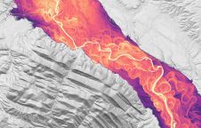
Driving new opportunities in the mapping landscape, a significant milestone has been achieved in New Zealand. With the introduction of 3D mapping data for the Waikato and Southland regions, access...

The integration of geospatial information software (GIS), remote sensing and surveying and mapping data has accelerated in recent years. Meanwhile, new technologies such as AI models and ChatGPT are emerging...
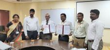
Terra Drone India, an associate company of Japan-based Terra Drone Corporation, and Vignan’s Foundation for Science, Technology & Research (deemed-to-be a university) have co-established a drone laboratory to foster innovation...

It is time to innovate with technology that can be applied ‘right here, right now’. That was the clear message during HxGN LIVE Global 2023. President and CEO Paolo Guglielmini...
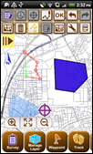
Supergeo Technologies, the provider of complete GIS mapping software and solutions, has announced that SuperSurv 3.1 assisted the Faculty of Human Ecology at the University of Putra, Malaysia, in completing...
This site uses cookies. By continuing to use this website, you agree to our Cookies Policy. Agree