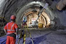
There is a general acknowledgement in the scanning and mapping industry that, compared to terrestrial laser scanners (TLS), mobile mapping systems significantly increase scanning speed and point cloud coverage. This is especially true for building interiors and equipment. This results in reduced time on site, which in turn lowers the cost of scanning for the service provider. There is a general acknowledgement in the scanning and mapping industry that, compared to terrestrial laser scanners (TLS), mobile mapping systems significantly increase scanning speed and point cloud coverage. This...