A Drone Survey of a Wind Farm Access Road
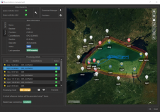
Maintaining a large wind farm requires constant and reliable access. UAV technology was successfully used to survey the construction of an access road in a recent project in Norway. Drone...
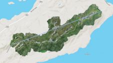
Maintaining a large wind farm requires constant and reliable access. UAV technology was successfully used to survey the construction of an access road in a recent project in Norway. Drone...

In this years' Business Guide, GIM International attempts to look beyond the end of the COVID-19 pandemic, to paint a picture of where the geospatial industry is heading and what...
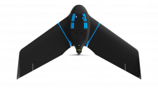
senseFly has expanded its flagship eBee X UAV solution with the launch of eBee Geo, the first in a new series of fixed-wing mapping drones. eBee Geo is a cost-effective option...
Why are UAVs increasingly supplementing or even replacing terrestrial survey methods for many applications? This article explores the advantages of photogrammetric mapping with UAVs. Unmanned aerial vehicle (UAV or 'drone')...
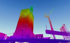
When it comes to 3D modelling for construction, what are the advantages and disadvantages of photogrammetry versus Lidar in terms of accuracy, complexity and cost? Breaking away from laser measurement...
SBG Systems is introducing the Virtual Base Station feature in its in-house post-processing software called Qinertia. Geospatial professionals benefit from an optimal centimetric position accuracy in all their projects, even...
With the new release of the Condor V8-PPK mapping drone, Munich-based Videographics Ingenieurgesellschaft has completed its toolbox for most precise photogrammetric aerial mapping and surveying projects. The German company Videographics...
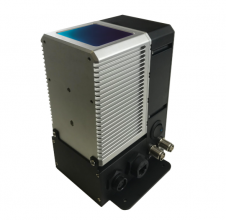
PolyExplore has launched the Polyscanner LS1, a high-precision Lidar mapping system designed for UAVs and other aerial platforms. Based around advanced solid-state Lidar technology, the Polyscanner LS1 uses an innovative...

Quantum-Systems and Pix4D have formalized their partnership to simplify daily operations for their shared customers. Professionals around the globe rely on eVTOL UAVs from Quantum-Systems and Pix4D’s software suite for collecting and post-processing...
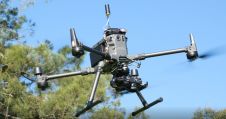
Klau Geomatics has released a new mapping payload for DJI M3000 that weighs just under 1 kilogram. A KlauPPK module mounted via the Klau Geomatics Sony gimbal connects straight into the...
This site uses cookies. By continuing to use this website, you agree to our Cookies Policy. Agree