Coptrz and Wingtra Enter Strategic Partnership
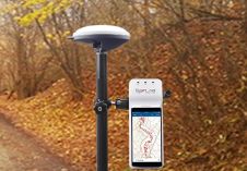
Coptrz, a UK-based commercial drone solutions provider, has become the first premium partner in Europe of Wingtra, a VTOL fixed-wing UAV manufacturer based in Switzerland. Coptrz and Wingtra began working together...