ArcGIS GeoBIM Brings Spatial Context to AEC Operations
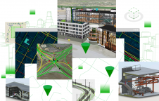
Esri has released ArcGIS GeoBIM to expand the ability for BIM teams to benefit from GIS. This is the latest step in the partnership between the global leader in location...
Esri has released ArcGIS GeoBIM to expand the ability for BIM teams to benefit from GIS. This is the latest step in the partnership between the global leader in location...
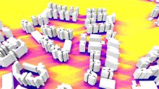
Due to the local region’s proneness to occasional wildfires, the Geomatics Division at the University of Cape Town, South Africa, has conducted research and project work around the theme of 3D...
The concept of the digital twin has been gaining significant momentum in the geospatial domain since 2016. Although there is some consensus on the basic features of a digital twin,...
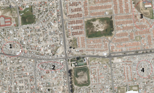
Surveying and mapping are an important foundation for the development of a national economy. An accurate understanding of the spatial configuration of a territory and information about its attributes is...
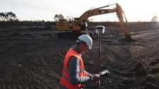
Trimble has announced enhancements to its industry- leading Trimble RTX correction services, tailored to meet the evolving needs of geospatial professionals. As part of an ongoing strategy to deliver premier...
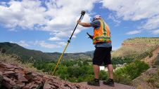
During the early days of Global Positioning System (GPS) technology in the 1980s and 1990s, surveyors had to chase satellite geometry and spend long hours collecting data in order to...
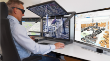
Schneider Digital has officially certified the compatibility of Esri's ArcGIS Pro software with the entire 3D PluraView monitor product family. ArcGIS Pro integrates important functionalities from photogrammetry, such as importing...
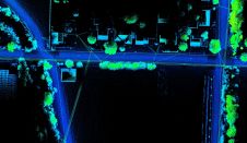
Both vehicle-based and UAV-based Lidar systems from Routescene have been used in a survey to prepare for the replacement of aging power lines in Oliver, British Columbia, Canada. Electricity distribution...

Septentrio and XenomatiX are starting a partnership enabling high-quality Lidar solutions. Septentrio is a leader in advanced GNSS/INS positioning solutions, while XenomatiX is a provider of true-solid-state-Lidar technology for autonomous...
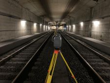
GeoNext has used Trimble technology to survey the Schiphol Tunnel and provide measurements as the basis for a 3D model to support essential railway maintenance and upgrades. Millions of passengers...
This site uses cookies. By continuing to use this website, you agree to our Cookies Policy. Agree