Predicting Fire Risk with UAV Lidar
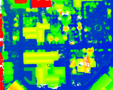
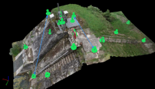
A forest fire site has been assessed using both high-resolution Lidar captured from a drone and satellite optical imagery to appraise the potential of this approach for the future. After...
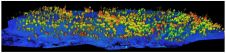
A forest fire site has been assessed using both high-resolution Lidar captured from a drone and satellite optical imagery to appraise the potential of this approach for the future. After...

Septentrio has launched a new product line of high-performance GNSS/INS receivers called AsteRx-i3. The AsteRx-i3 product family brings to market an array of next-generation receivers from plug-and-play navigation solutions to...
Topcon Positioning Group has launched its Magnet 7 suite of software for construction and survey professionals. Magnet 7 is designed to utilize the strength that cloud-based connectivity can play in...
DJI recently introduced the P4 multispectral, a high-precision unmanned aerial vehicle (UAV or ‘drone’) which exploits the integration of multispectral cameras to facilitate agricultural and environmental monitoring applications. Therefore, imagery...
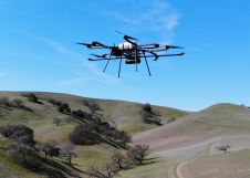
Small improvements to a drone Lidar survey can make big differences in efficiency, productivity and safety. The drone's battery life impacts on the drone's flight time and is a major...

Harxon has just launched its TS112 family of smart antennas, designed for demanding applications such as autosteering systems for agricultural machinery that require high positioning-accuracy solutions. The newly released TS112...

M300 pro II is designed for telecom providers to provide high presicion services. On the ground of M300 Pro, M300 Pro II adds an optical fiber interface and a built-in...

Harxon Corporation, founded in 2008, is a customer-focused enterprise carrying out innovative R&D, manufacturing and selling in the fields of high-precision GNSS antennas and ultra-reliable wireless data transmission radio modems...
As the FIG commission chairs near the halfway point in their terms, they reflect on the global and technological drivers influencing their work. This article describes the breadth of work...
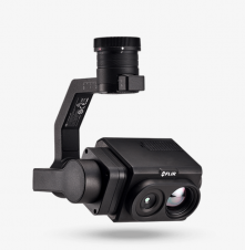
Teledyne Technologies Incorporated will acquire FLIR Systems in a cash and stock transaction valued at approximately US$8 billion. Under the terms of the agreement, FLIR stockholders will receive US$28.00 per...
This site uses cookies. By continuing to use this website, you agree to our Cookies Policy. Agree