Key Global and Technology Drivers Impacting Surveying
As the FIG commission chairs near the halfway point in their terms, they reflect on the global and technological drivers influencing their work. This article describes the breadth of work...
As the FIG commission chairs near the halfway point in their terms, they reflect on the global and technological drivers influencing their work. This article describes the breadth of work...
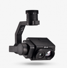
Teledyne Technologies Incorporated will acquire FLIR Systems in a cash and stock transaction valued at approximately US$8 billion. Under the terms of the agreement, FLIR stockholders will receive US$28.00 per...
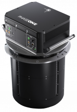
Phase One has unveiled the PAS 880, a fully integrated large-format nadir and oblique camera system for aerial mapping. The PAS 880 integrates a 280MP nadir camera with four oblique...
The new iPhone 12 Pro is equipped with a Lidar sensor, marking an encouraging step towards the democratization of photogrammetry and 3D scanning. Smartphones equipped with a laser scanner have...
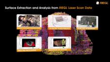
Watch the video and get an insight how RIEGL 3D Terrestrial Laser Scanners, RIEGL’s proven software RiSCAN PRO and the LIS GeoTec Plugin support the geologist’s work and provide the...

Despite having to improvise, this year’s pioneering digital edition of Intergeo has received a lot of positive feedback. It became the international geospatial industry’s first-ever online-only event after the COVID-19...

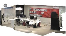
Pix4D has released a new app for ground imagery acquisition: Pix4Dcatch. The app has been developed to empower users to easily create ground-based 3D models using an iOS mobile device....
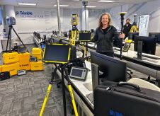
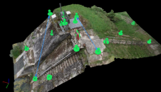
The University of Colorado in Denver, USA, has received a significant gift from Trimble to establish a state-of-the-art Technology Lab for the College of Engineering, Design and Computing. The gift...
With the new release of the Condor V8-PPK mapping drone, Munich-based Videographics Ingenieurgesellschaft has completed its toolbox for most precise photogrammetric aerial mapping and surveying projects. The German company Videographics...
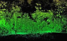
Bluesky International is co-funding research into the use of Lidar, machine learning and artificial intelligence to create citywide maps of trees enriched with new levels of information in an advanced postgraduate...
This site uses cookies. By continuing to use this website, you agree to our Cookies Policy. Agree