Found 2594 results
Sort by

Sensor Fusion for Precision Agriculture

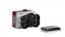
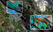
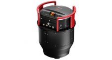
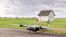
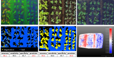
Precision agriculture has considerably benefited from the use of unmanned aerial vehicles, often combined with active ranging sensors like Lidar to gather information from underneath the crops, but existing systems...

Read more

AgEagle Unveils MicaSense RedEdge-P Drone Sensor

AgEagle Aerial Systems has launched MicaSense’s latest innovation in leading-edge drone sensor technology, the RedEdge-P. Offering three times the capture speed and twice the spatial resolution of the RedEdge-MX, the all-new RedEdge-P...

Read more

Digital twins for a sustainable world

How can city digital twins support the attainment of SDG11? They can be used to manage infrastructures (e.g. roads, transportation and public services, smarter energy grids and water networks), support...

Read more

MicaSense Unveils RedEdge Multispectral Sensor

MicaSense has released RedEdge-M, the evolution of its rugged, built-to-last, professional multispectral sensor, RedEdge. Easily integrated into a wide variety of drones, RedEdge-M enables agricultural enterprises, growers and researchers to...

Read more

New Trimble Digital Sensor System

Trimble (CA, USA) has introduced the Trimble DSS WideAngle, the latest option for its medium-format, directly georeferenced aerial imaging system. Capable of producing highly accurate orthophotos, stereo photos, and mosaics,...

Read more